Subscribe to receive top agriculture news
Be informed daily with these free e-newsletters

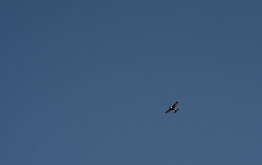
Already farmers are using drone technology for imaging purposes to determine a number of factors in their fields. Drones can take photographs in high resolution, superior to those taken through satellite imaging.
March 31, 2017
It's no secret that the use of unmanned aerial vehicles (UAVs), or drones, in agriculture is growing rapidly. But practical applications for drones on the farm and ranch are expanding faster now than ever before.
Already farmers are using drone technology for imaging purposes to determine a number of factors in their fields. Drones can take photographs in high resolution, superior to those taken through satellite imaging. Raw data collected by drones gets translated into useful and comprehensible information for farmers, thanks to specific algorithms.
Some of the information these images provide includes plant counting, plant size, plot statistics, stand number, compromised plots, and planter skips. They also can determine plant height, crop height and density, and vegetation indices, such as leaf area, anomaly detection, treatment efficacy, infestations, and phenology. They also help to determine water needs throughout the crop year.
MORE APPLICATION COMING
But in a recent report published by Farm Bureau News, research into drone technology and its potential uses for agriculture is pointing to greater use and versatility for drone applications on the farm and ranch.
Dr. Lav Khot, assistant professor, Precision Agriculture, Department of Biological Systems Engineering, Center for Precision and Automated Agricultural Systems, IAREC, Washington State University, has been working on multiple projects that demonstrate how drone use lends itself to many diverse applications in agriculture.
Through the use of thermal imaging, Khot is currently monitoring how crops fare under differing irrigation techniques, specifically, mid-elevation irrigation versus low-elevation irrigation systems.
With low-elevation irrigation, sprinklers are positioned close to the canopy so evaporation loss is reduced. Drone-gathered multi-spectral and thermal imaging data can then detect crop vigor and canopy stress as the team evaluates this cost-effective practice in potato and mint production.
Another irrigation-related project uses drones to see how wine grapes respond to subsurface irrigation, in which water is applied at various levels to the root of the plant—30 centimeters down, 60 centimeters down and 90 centimeters down.
In addition, Khot is looking at how drone imaging can help winter wheat farmers decide whether to forge ahead or reseed their fields after an earlier-than-expected cold snap. Such a cold spell could cause a hard layer to form on the winter wheat seed, preventing plant emergence. Drone imaging can give winter wheat farmers a better view of where and how many of their winter wheat plants may be sprouting toward the end of the winter season.
CROP FACTORS
In addition to evaluating irrigation techniques, Khot and fellow researcher Dr. R. Troy Peters, an irrigation engineer and Extension specialist, are looking at how certain crops, like potatoes and pinto beans, will respond to the climate of the future, one in which there will likely be less water for irrigation and warmer summer temperatures. Researchers are also looking at how tillage and no-tillage affect the beans and potatoes with the different levels of irrigation.
In addition to new research by Khot and associates, Massachusetts Institute of Technology (MIT) researchers are evaluating the diverse use of drone technology in agriculture. MIT researchers say thanks to robust investments and a more relaxed regulatory environment in recent months, the time for expansion of UAV use has arrived.
A report from MIT indicates the value of drone-powered solutions in all applicable industries is significant, more than $127 billion overall, and the most promising areas may be in agriculture, where drones offer the potential for addressing several major challenges.
According to the report, in the near future drone technology will give the agriculture industry a high-technology makeover, with planning and strategy based on real-time data gathering and processing.
Pwc, a global consulting and auditing giant who partnered with MIT in the study, reports drone use on the farm and ranch is estimated to grow by $32.4 billion over the next several years.
DRONE GROWTH AREAS
Pwc projects drone use in agriculture will grow significantly in the following areas:
Soil and field analysis: Drones can be instrumental at the start of the crop cycle. They produce precise 3-D maps for early soil analysis, useful in planning seed planting patterns. After planting, drone-driven soil analysis provides data for irrigation and nitrogen-level management.
Planting: Startups have created drone-planting systems that achieve an uptake rate of 75 percent and decrease planting costs by 85 percent. These systems shoot pods with seeds and plant nutrients into the soil, providing the plant all the nutrients necessary to sustain life.
Crop spraying: Distance-measuring equipment—ultrasonic echoing and lasers such as those used in the light-detection and ranging, or LiDAR, method—enables a drone to adjust altitude as the topography and geography vary, and thus avoid collisions. Consequently, drones can scan the ground and spray the correct amount of liquid, modulating distance from the ground and spraying in real time for even coverage. The result: increased efficiency with a reduction of in the amount of chemicals penetrating into groundwater. In fact, experts estimate that aerial spraying can be completed up to five times faster with drones than with traditional machinery.
Crop monitoring: Vast fields and low efficiency in crop monitoring together create farming’s largest obstacle. Monitoring challenges are exacerbated by increasingly unpredictable weather conditions, which drive risk and field maintenance costs. Previously, satellite imagery offered the most advanced form of monitoring. But there were drawbacks. Images had to be ordered in advance, could be taken only once a day, and were imprecise. Further, services were extremely costly and the images’ quality typically suffered on certain days. Today, time-series animations can show the precise development of a crop and reveal production inefficiencies, enabling better crop management.
Irrigation: Drones with hyperspectral, multispectral, or thermal sensors can identify which parts of a field are dry or need improvements. Additionally, once the crop is growing, drones allow the calculation of the vegetation index, which describes the relative density and health of the crop, and show the heat signature, the amount of energy or heat the crop emits.
Health assessment: It’s essential to assess crop health and spot bacterial or fungal infections on trees. By scanning a crop using both visible and near-infrared light, drone-carried devices can identify which plants reflect different amounts of green light and NIR light. This information can produce multispectral images that track changes in plants and indicate their health. A speedy response can save an entire orchard. In addition, as soon as a sickness is discovered, farmers can apply and monitor remedies more precisely. These two possibilities increase a plant’s ability to overcome disease. And in the case of crop failure, the farmer will be able to document losses more efficiently for insurance claims.
MANY MORE OPTIONS
As new investments filter into drone technology as it applies to agriculture, researchers say more use for drone technology will become apparent. For example, the recent loss of livestock as a result of serious winter blizzard conditions across the plains during this past winter season, and more recently wildfires that swept across Kansas, Nebraska, Oklahoma, Texas and Colorado, cost livestock producers millions of dollars. With GPS locator devices as part of livestock ear tags, many of the lost livestock that survived the fires and the winter blizzard could have been located more efficiently, saving both time and money than by traditional location methods.
Khot, Peters and MIT researchers say drone technology's future in agriculture is bright, and it is quickly gaining momentum as hardware and software costs are reduced.
Farm Bureau has announced Agriculture-related drone research, and much more will be the topic of and discussed at the Drone World Expo, a two-day conference that focuses on the latest advancements in the commercial drone industry. The event will take place Oct. 3-4 (2017) in San Jose, California.
The conference will feature sessions and case studies addressing the ever-evolving regulatory environment for commercial drone use, as well as the most up-to-date and critical information for professionals using drone technology for agriculture, mapping and surveying, utilities, oil and gas, conservation initiatives, real estate and much more.
Farm Bureau members who are end-users of drone technology qualify for a complimentary full conference pass. Non-end-users will receive free expo passes, which include admission to exhibits, keynotes, Tech Talks, demos and receptions. For more information, go to www.droneworldexpo.com/fbn.
You May Also Like
Enter a zip code to see the weather conditions for a different location.


