

Subscribe to receive top agriculture news
Be informed daily with these free e-newsletters

Atmospheric river takes aim at California. Forecasters say several inches of rain could fall on major growing regions in California as the Sierra snow pack could improve by several feet.
By the end of the week rainfall totals could be measured in inches and new snowfall in feet as California looks to be the target of a series of major winter storms.
The seven-day precipitation forecast for the state shows that rainfall amounts could range from about a quarter-inch in the southwestern San Joaquin Valley to more than six inches in total along the eastern edge of the Sacramento Valley from Yuba City to Chico.
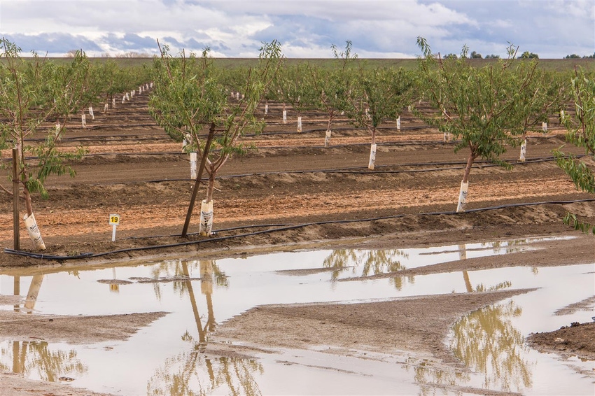
Of additional concern for farmers in the Sacramento Valley could be strong winds that may cause issues with tree crops growing in the water-logged soils in that region.
Citrus growers in the San Joaquin Valley are watching the sky and forecast as well, according to Bob Blakely, vice president of California Citrus Mutual.
Blakely says the heavy rain will stop harvest activities as the fruit needs to be dry before it can be harvested. This means crews would likely be active just ahead of the storm in an attempt to fill packing sheds with fruit for further processing.
“The rain will definitely slow down our harvest,” Blakely says.
Even after the rain Blakely suspects harvest activities will be slowed as it could be difficult or impossible to get into the groves to pick the fruit.
What weather forecasters typically call an “atmospheric river” is set up to affect California from about Bakersfield, north. South of there, which includes the desert growing region of Imperial County, will likely only see a few clouds, according to forecasters.
Because the storm track will basically hit California from the west, rainfall amounts should be heaviest along the coast and again on the western slopes of the Sierra Nevada. Rain shadow effects from the coastal mountains should cause reduced rainfall along the western edge of the San Joaquin Valley.
Over a foot of rain and snow is forecast to fall on the Sierra Nevada, where nearly three feet of snow was measured during the January snow survey conducted by the California Department of Water Resources (DWR) on Tuesday.
The Jan. 4 snow survey found over 34 inches of new snow with a water content of six inches at one of the sites DWR uses to measure snowpack and predict water storage conditions for the season. Much of that snow fell over the previous weekend.
The latest weather forecast for California means more rain and snow on top of record amounts that fell in October.
The wet weather has largely been positive for California’s parched farmland, as it has provided a significant boost in water storage at key reservoirs.
Shasta Lake near Redding has added well over 400,000 acre feet of new storage in the past month due to the storms. A similar story was reported at Folsom Reservoir near Sacramento, which around Christmas saw flood flow releases employed to keep the reservoir from filling too fast.
Some of those flood releases were captured by pumps in the San Joaquin River Delta and moved to San Luis Reservoir, where water levels were boosted by more than 315,000 acre feet in the past month to over 1.2 million acre feet of total storage. That is about half of the overall storage capacity of the off-stream site that was built to convey water to farmers south of the Delta.
Rain that had already begun by Tuesday in parts of the state will continue through the rest of the week, with a slight respite on Friday. More rain is forecast to follow that break in the weather. A winter storm watch is in effect for the Sierra Nevada with a flash flood watch posted for the Sierra and its westward-facing foothills as snow levels are forecasted to be above 7,000 feet elevation during these storms.
Arizona is projected to only see a few clouds and possibly a sprinkle from this series of storms, according to the National Weather Service.
You May Also Like
Enter a zip code to see the weather conditions for a different location.


