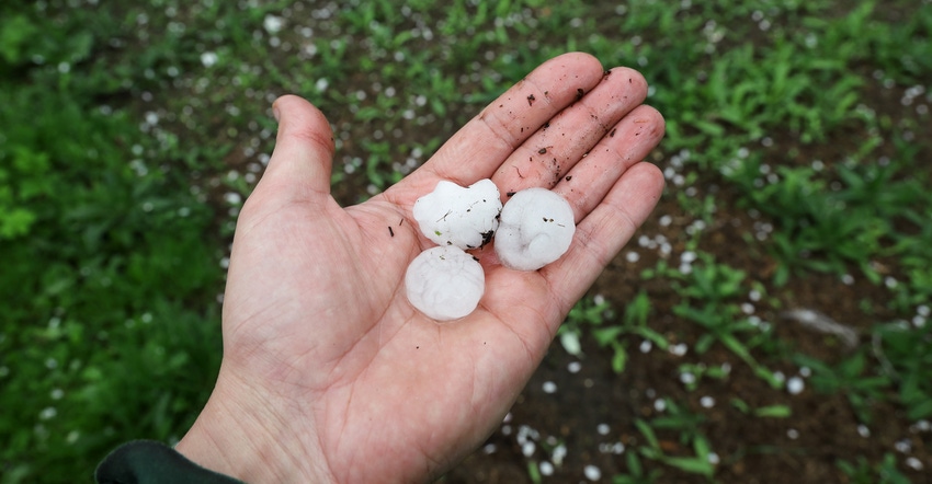
How would you respond if someone asked you if hail, snow and sleet were all the same — frozen precipitation? Knowing the answer might help you prepare for meteorological trivia. It also might help you better understand when to expect them, plus another less familiar one: graupel.
“These are all different forms of frozen precipitation,” says Beth Hall, the Indiana state climatologist and director of the Midwestern Regional Climate Center, located at Purdue University. “Hail is associated with summer thunderstorms, while the other three typically come from winter storms, although they can occur in late fall or early spring.”
For hail, the general accepted theory is that circulation within thunderstorms forces hailstones back and forth within warm and cold zones within the cloud, Hall explains. The more time hailstones spend batted back and forth, the bigger they get. At some point, turbulence grows so intense that it throws the stones out.
“Updrafts and downdrafts exist within these strong summer thunderstorms,” Hall notes. “Hailstones are often hurled down with force in one of these downdrafts. There are two reasons why they do so much damage. They often develop significant size, or mass, plus they come crashing down with force due to the storm itself.”
You’ve heard the term “downpour” or the phrase “raining cats and dogs.” These describe heavy rainfall when large raindrops are driven to earth with force similar to when hailstones crash down, Hall explains.
Freezing precipitation
Here is a closer look at three forms of frozen precipitation associated with cool or cold weather:
Snow. If the air can’t hold any more vapor, it condenses. If it’s above freezing, you get cloud droplets or steam droplets. But if condensation occurs below freezing, vapor skips the liquid phase and crystallizes as snow, Hall says. Snow forms in clouds when temperatures are well below freezing. If it falls through cold air on its path to earth, it arrives as snowflakes.
Sleet or ice pellets. If snowflakes encounter warmer layers of air as they fall, they can melt, depending upon the thickness of the warmer air layer. If they melt but pass through another cold layer of air above the ground, they refreeze and form sleet. Sometimes people refer to individual pieces of sleet as ice pellets.
Graupel. This is a term you don’t hear often. Graupel was officially reported during a late-winter weather event over Westfield in central Indiana this spring. Observers mistakenly called it hail, but it was officially identified as graupel by the National Weather Service. The timing was certainly right for frozen winter precipitation, not hail, Hall says.
Graupel also results when snowflakes encounter warmer air and begin melting, but then refreeze and fall, often having a different shape than snowflakes but also a different appearance than sleet. One source indicates that supercooled raindrops may attach to melting snowflakes and refreeze, forming graupel.
It’s sometimes called “soft hail,” but that’s a misnomer. “Graupel is clearly another form of frozen winter-type precipitation,” Hall says. “Hail is much harder, usually larger, much more damaging and almost exclusively associated with severe summer thunderstorms.”
About the Author(s)
You May Also Like

