It looks like the El Nino is living up to its name.
This warming of the equatorial Pacific is traditionally observed around Christmas, and its name refers to the Christ child in Spanish. Government forecasters today increased odds the event will develop this winter and last into spring.
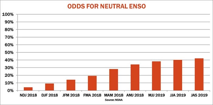
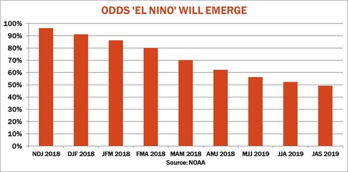
In its latest report on the cycle of warming and cooling, the Climate Prediction Center of the National Weather Service raised the odds for El Nino during November-January to 96%, up from 84% last month. While surface sea temperatures in the Pacific met the threshold for El Nino in November, forecasters said other factors kept the official reading neutral. By definition, El Nino must be present for three consecutive months.
This month’s update showed better than 50% odds of El Nino persisting into the June-August period. If it lasts into the fall, U.S. farmers could see above average yields for corn, soybeans and wheat.
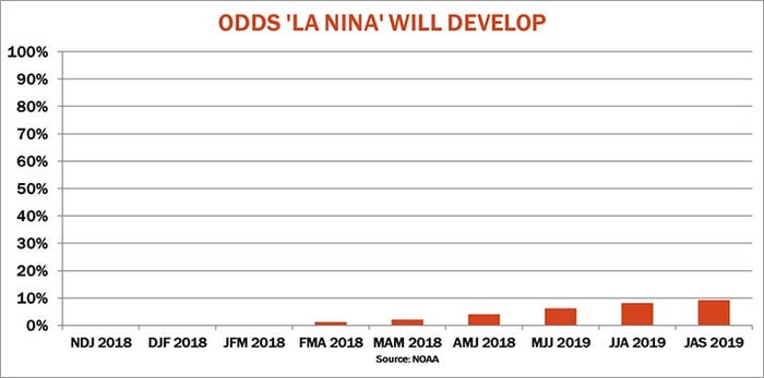
Corn and soybean growers fear El Nino’s twin, La Nina, which is the cooling of the equatorial Pacific. These events have been seen during some, but not all, of the big droughts in the U.S.
But El Nino works the other way. Rather than heat and dry conditions, It tends to bring more abundant rainfall and moderate temperatures. El Ninos that develop in the fall or winter are associated with above average winter wheat yields the next summer. If the event starts by summer and lasts into the following fall, chances for above average corn and soybean yields are noted historically.
Still, while traders sometimes like to make a big deal of the El Nino/Southern Oscillation cycle, as it’s known, it’s important to remember that the correlations between this weather event yields, though statistically significant, is relatively small. Weather is complicated, especially as it relates to crop yields grown over large regions like the U.S.


About the Author(s)
You May Also Like


