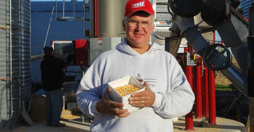
Above-average rainfall kept combines out of the field again last week across most of Iowa. Gazing at the water standing in his soybean field on Oct. 9, central Iowa farmer Brad Moeckly remarked: “If it quit raining today and the sun began shining every day, it would still be a week to 10 days before we could begin harvesting. It’s that muddy.”
Indeed, this run of extremely wet fall weather has slowed harvest progress dramatically, and Iowa’s 2018 soybean harvest is now well behind the five-year average. USDA’s weekly survey shows 18% of the soybean crop has been harvested as of Oct. 7, and only 15% of the state’s corn crop is in the bin.
So far, Moeckly’s soybean yields have been better than expected and corn yields lower than expected.
“We’re just barely started on soybean harvest, but we have harvested some 80-bushel beans,” he said. “On corn, we are also 10% to 15% harvested. Corn yields are averaging around 185 bushels per acre. There are places within cornfields where the yield monitor registers 225 or 230 or more. But there are also the poorly drained areas in those fields where the yield is a lot lower, bringing the average down.”
In Polk County where Moeckly farms, there are mostly flat fields, and it rained a lot earlier in the growing season, filling up the potholes, setting crops back and limiting yield potential. Thanks to a rainy fall, those poorly drained areas of fields have water standing in them once again.
The complete weekly Iowa Crop Progress and Weather Report is at iowaagriculture.gov and nass.usda.gov/ia.
Crop report
Continued wet weather conditions allowed Iowa farmers just 1.6 days suitable for fieldwork during the week ending Oct. 7, according to USDA’s National Ag Statistics Service. Activities for the week included harvesting corn and soybeans when weather permitted.
Topsoil moisture on average statewide rated zero percent very short, zero percent short, 41% adequate and 59% surplus. Subsoil moisture rated 1% very short, 2% short, 50% adequate and 47% surplus. Recent rains have boosted topsoil moisture supplies in south-central and southeast Iowa, where it was dry this past summer. Those parts of the state are now running 99% adequate to surplus soil moisture.
As of Oct. 7, the survey showed 95% percent of the 2018 Iowa corn crop was mature, nine days ahead of average. And 15% of the state’s corn for grain has been harvested, 10 days ahead of last year. Farmers in southeast Iowa continue to lead the way with 39% of their corn for grain harvested. Moisture content of field corn being harvested in Iowa last week was averaging 20%. Corn condition is rated 70% good-to-excellent.
Nearly all the Iowa soybean crop was coloring with 94% dropping leaves, eight days ahead of average. Looking at Iowa’s soybean crop as of Oct. 7, 18% of the crop has been harvested, five days behind average. Soybean condition is rated 70% good-to-excellent.
Iowa’s third cutting of alfalfa hay was nearly complete at 98% as of Oct. 7. Pasture condition improved slightly to 55% good-to-excellent. Muddy feedlot conditions have been a challenge for cattle producers this fall.
Weather summary
According to Justin Glisan, IDALS climatologist, the first week of October had unsettled conditions statewide with above-average rainfall and generally below-average temperatures. Precipitation totals were up to 4 inches above normal, with higher accumulations in eastern Iowa. Temperatures were cooler than expected, except in the southeast corner of the state.
Oct. 1 was a rainy day for Iowa’s northern two-thirds, as a low-pressure system moved into the state. Rainfall totals into the morning of Oct. 2 were above 1 inch for over 40 stations, with Dubuque (Dubuque County) reporting 2.31 inches, which is 2.21 inches above normal. Average high temperatures ranged from the 50s in northwest Iowa with gradual warming into the lower 70s toward the southeast.
Showers and thunderstorms continued across northern parts of Iowa during the day on Oct. 3. Statewide highs were in the upper 70s and low 80s. Late in the evening a cold front moved through Iowa, bringing rain to the southeast. Accumulations were under an inch, with Newton (Jasper County) observing the highest total of 0.81 inch. With the cold front exiting Iowa early Oct. 4, highs cooled into the 50s.
Multiple rounds of showers and thunderstorms moved through Iowa Oct. 5-7, especially across the southern and eastern counties. Heavy rain was observed in eastern Iowa the evening of Oct. 5 into early Oct. 6. Williamsburg (Iowa County) reported 3.65 inches — 3.55 inches above average. Weather reporting stations from Marion County to Scott County recorded accumulations above 2 inches. Measurable rainfall was reported across much of Iowa on Sunday.
Weekend high temperatures ranged from the upper 40s in the north to lower 60s in the south. De Soto (Harrison County) observed the week’s warmest temperature of 93 degrees on Oct. 2, while Estherville (Emmet County) reported the week’s low of 30 degrees on Oct. 4.
For the week ending Oct. 7, statewide average precipitation was around 1.61 inches, which is 0.93 inch above the average of 0.68 inch.
About the Author(s)
You May Also Like

