Subscribe to receive top agriculture news
Be informed daily with these free e-newsletters

La Nina is coming: Here is what could happen
Updated with May 12 information from Climate Prediction Center.
The National Weather Service’s Climate Prediction Center on Thursday raised the chance for a La Nina event this year to 75% from its previous 65%.
“Overall, La Nina is favored to develop during the Northern Hemisphere summer 2016, with about a 75% chance of La Nina during the fall and winter 2016-17,” the CPC said.
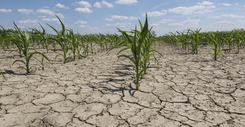
Droughts have occurred in the United States when La Nina events are developing or are underway, the latest being 2012.

Droughts have occured in the United States when La Nina events are developing or underway. (Photo: Taglass/Thinkstock)
La Nina is the cooling of surface waters in the equatorial Pacific Ocean. That is the opposite of El Nino, which is the warming of the surface waters. As the National Weather Service explains, cool waters tend to dry things out, while warmer waters provide moisture that fuels Pacific storms.
“Drier than normal conditions along the west coast of tropical South America, and at subtropical latitudes of North America (Gulf Coast) and South America (southern Brazil to central Argentina) are associated with cold episodes during their respective winter seasons,” the Climate Prediction Center said of La Nina.
There have been several La Nina episodes since 2000, during the 2012 event one of the worst droughts in U.S. history occurred. That drought hurt crops and sent corn and soybean prices to record highs.
Another La Nina year was in 1988. That also was a drought year that included a summer heat wave that killed thousands of people and livestock. Soybean prices moved past $10 a bushel that summer for the first time ever and corn topped $2.70.
The transition period from an El Nino to a La Nino can skew weather patterns. For this summer, forecasts indicate warmer-than-normal weather for the contiguous United States and includes expectations for above-normal precipitation from Nevada to Nebraska, said Matthew Rosencrans, head of forecast operations at the Climate Prediction Center. Precipitation patterns elsewhere in the United States should not be affected.
Weather around the world also should be affected by the transition to a La Nina.
“Data analyzed by the Climate Prediction Center reveals associations between drier than normal conditions in Southeast Asia, implying a delayed start to the monsoon there, and a transition to La Nina conditions. Linkages between La Nina and precipitation also imply above-normal precipitation for eastern South America, particularly Eastern Brazil,” Rosencrans told Farm Futures earlier in May.
Once La Nina arrives above-normal precipitation could be expected from November to January in northeast Brazil, drier conditions in northeast Argentina, Paraguay and southeastern Brazil. Southeast Australia may be drier than normal, while Indonesia, Malaysia and northern Philippines could have above-normal precipitation.


How will El Nino impact corn and soybean yields? -- >>>
~~~PAGE_BREAK_HERE~~~


You May Also Like
Enter a zip code to see the weather conditions for a different location.


