Subscribe to receive top agriculture news
Be informed daily with these free e-newsletters

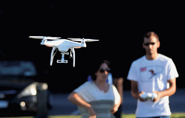
"From an ag perspective, these vehicles aren’t going to replace anything; rather, my feeling is they’re going to find a fit as observational platforms that can provide high resolution imagery.”

Unmanned aerial systems (UASs) are going to increasingly be used in agriculture, as more ways are found for them to be of benefit to farmers and agribusinesses, says Robert Moorhead. But don’t look for them to replace aerial applicators anytime soon.
“When I talk with aerial applicators, I emphasize that these systems aren’t going to put you out of business,” he says. Rather, he sees them as being complementary.

ROBERT MOORHEAD
ROBERT MOORHEADAnd says Moorhead, professor of electrical and computer engineering and director of the Geosystems Research Institute and Northern Gulf Institute at Mississippi State University, aerial applicators understand that the systems can have benefits for them.
“By doing surveillance and analysis of field and crop conditions with unmanned systems, the aerial applicator, using precision application technology, can deliver less chemical or fertilizer over a smaller area,” he said at the annual meeting of the Mississippi Agricultural Economics Association.
“As one Mississippi Delta aerial applicator told me, ‘We’ll be going up fewer times per day. If I can get a job done with less peak load, that will potentially reduce my costs. I may have to charge more per acre, but I’ll be applying materials on fewer acres, so the farmer and I will both save money.’”
There are few UASs available that are made for hauling a sizable load, Moorhead notes. “These systems aren’t going to put aerial applicators out of business, because you’d have to carry a lot of stuff to achieve economic efficiency. Also, the FAA really has a problem with anything that changes its weight as it goes along, or is dropping stuff from the sky — which has connotations for terrorists. Until these systems can prove themselves for those types of jobs, the Federal Aviation Administration (FAA) just isn’t going to let you do it.”
Unmanned aerial systems (UAS) are a good fit for dirty operations, Moorhead says. “Dirt and agriculture just seem to go together. These systems are efficient, economical, environmentally friendly, and safer — you don’t have a person in the cockpit, and they use a lot less fuel.”
But, he emphasizes, a human is a very important component in their operation. “The FAA is the Highway Patrol of the sky. Even though these aircraft are controlled by computers and GPS while in flight, the FAA requires that the operator be able to take over control at any time during the flight. This isn’t total technology — there’s a human factor associated with their operation.”
Currently available systems come in all sizes, he says, from small as hummingbird to as big as manned aircraft. “But for most agricultural uses, we’re talking hand-launched aircraft, 20 lbs. or less. From an ag perspective, these vehicles aren’t going to replace anything; rather, my feeling is they’re going to find a fit as observational platforms that can provide high resolution imagery.”
What type of UAS will a farmer want?
“It depends on what you want to do,” Moorhead says, and as the technology matures, he expects producers will have more than one type of UAS for different jobs.
“If you’ve got an irrigation pump on the backside of the field, you may want to something that can fly out and see what the meter says. But if you want to see if some feral pigs are rooting up your corn, you may want a different kind of vehicle that can go out there and hover, see how many animals are present, how big they are. If you’re monitoring crop emergence, you’ll want a system equipped with a high resolution camera.
“We have images of crops on our north farm with resolution of 1/8 inch. We can see crop emergence over a large area — we can cover a couple hundred acres per hour at that resolution. You may want to want to look at land elevation, or check on crop health during the year. You may want to check crop drydown status with a thermal camera, a project that Jason Ward, MSU agricultural engineer, and I are working on.”

LEE HATHCOCK, a coordinator with the Mississippi State University Geosystems Research Institute, prepares to launch an unmanned aerial vehicle at the MSU Black Belt Experiment Station in Brooksville, Mississippi.—Photo: MSU Ag Communications/Kat Lawrence
LEE HATHCOCK, a coordinator with the Mississippi State University Geosystems Research Institute, prepares to launch an unmanned aerial vehicle at the MSU Black Belt Experiment Station in Brooksville, Mississippi.—Photo: MSU Ag Communications/Kat LawrenceUASs will be widely used for crop scouting, Moorhead says. “You’ll be able to zoom in on problem areas, rather than just looking at an entire field. With 1/8 inch resolution, crop scouting is going to get much more technically capable. There will be a wide array of sensors that can detect many different crop conditions.”
Precision agriculture systems are increasingly being incorporated into farm equipment, he notes, and farmers are making use of a wide variety of high tech farm management systems. “All these are data-driven, and UAS technology adds another significant layer of data for researchers — and ultimately, crop consultants and producers — to assess and utilize in a meaningful way.”
Stay informed on what’s happening in Mid-South agriculture: Subscribe to Delta Farm Press Daily.
By 2020, he says, “there will be many more UASs available, with a wide array of uses — many we haven’t even thought of yet. These systems will be widely available, at Best Buy, other outlets. They’re going to get better and better, just as we’ve seen happen with cell phones and other digital technology. The Department of Defense has spent billions of dollars developing UAV systems for the military, and the good news is that a lot of that technology filters down to the consumer market, at a fraction of the cost.
“There will be much more information generated by these systems — we’ll still be drowning in data, but we will increasingly have more useful information. These systems will be safer, much more reliable. Farmers will be able to utilize multiple kinds of UAVs and payloads.”
Now though, Moorhead says, the systems continue to be refined and made more versatile, and users await the FAA’s rules on what can and can’t be done with them in terms of airspace, privacy, etc.
“The FAA has put some teeth in their enforcement,” he says. “Recently, they imposed a $1.9 million fine on a company flying a UAV over New York and Chicago. UAV operators need to wake up and be careful about what they’re doing with these systems.
“The FAA is accustomed to dealing with aircraft that are big enough to be easily seen, and with rules that protect the safety of the people on board. Now, they’re dealing with a proliferation of UASs that are basically flying cell phones, and they’ve got to figure out how to regulate them.”

A FIXED-WING unmanned aerial vehicle flies above a research plot of corn at Mississippi State's R.R. Foil Plant Science Research Center. MSU's Geosystems Research Institute collaborates with university agronomists on several projects involving the use of unmanned aerial systems in precision agriculture.—Photo: Beth Wynn
A FIXED-WING unmanned aerial vehicle flies above a research plot of corn at Mississippi State's R.R. Foil Plant Science Research Center. MSU's Geosystems Research Institute collaborates with university agronomists on several projects involving the use of unmanned aerial systems in precision agriculture.—Photo: Beth WynnCurrently, Moorhead says, there are three classes of UAS operators: hobbyist, public, and civilian. “Congress told the FAA to come up with reasonable rules to make these systems work for the public, and to make some limited allowance for their use in the national airspace until rules are in place.”
The FAA received over 4,500 comments in response to its ruling notice, he says, and it’s expected that the rules will be issued in June 2016.
Check current commodity prices
“At present,” he says, “there are no constraints on how fast a UAV can fly or how much it costs. It’s perfectly legal for a hobbyist to go and buy a $3 million F16 model that will fly 155 mph hour, as long he follows the rules. But if you buy a little balsa airplane, mount a camera on it, and take photos and sell them to a national magazine, you’ve broken a federal law.”
However, a Section 333 waiver allows operators to make money with UASs. Last April, he says, the FAA had approved just 53 waivers and had 600 waiting. As of Sept. 1, they had approved almost 2,000.
Privacy and legal concerns will continue to be issues, Moorhead says. “But people don’t realize how many places they’re already on camera — in stores, restaurants, banks, on the street — and that’s only going to increase as surveillance systems increase.”
Among the commonly purchased unmanned aerial systems are:
DJI Phantom: “This is one of the most common systems,” Moorhead says. “In February, we had a couple on display at the Mid-South Farm and Gin Show at Memphis, and there was quite a bit of interest. I know some farmers already have them. We bought one 15 months ago for $1,300, and we’ve since added a second.
“You can probably get one now for $1,000 or under. They have 22 minutes of flight time, can fly 33 mph at a maximum altitude of 1,000 feet, and weigh 3 lbs. They’re easy to learn to fly safely and effectively. We have a thermal camera mounted on one, which we’re evaluating for looking for feral hogs or lost people in search-and-rescue situations. They can help emergency or disaster response people to evaluate situations more quickly.” http://www.dji.com
Robota Triton. This model has 30-60 minutes of flight time, flies 20-35 mph, weighs 3 lbs., and can cost $5,000. “Ours has two cameras, is a workhorse, and is very reliable,” Moorhead says.
“We bought one in November 2013, because it was one of the few with which we could get a multi-spectral camera. It has worked well in photographing small plots, but we haven’t been able to make mosaics of the data very well. Cameras for these are very good; for $500, you can get a 20 megapixel camera.
“One problem, it’s not waterproof. If there’s dew in the morning, or heavy fog, you can have problems landing.” http://www.robota.us
Precision Hawk Lancaster. “This model has a lot of sensor options, and is a very versatile, capable system. It sells for about $24,000.” http://www.precisionhawk.com
Altavian Nova. “Another very good system, with a lot of options and versatility.” Waterproof. Larger. More stable. Cost is approximately $42,000. https://altavian.com/Products
“These systems are constantly changing, as technology and cameras are improved,” Moorhead says. “It’s likely they will be like cellphones: You don’t expect them to last forever, and you replace them from time to time as better, cheaper models come along.”
The domestic UAS market is projected to create more than 200,000 jobs and $82 billion in economic impact in the first decade after FAA integration is complete.—Getty Images/Bruce Bennett
The domestic UAS market is projected to create more than 200,000 jobs and $82 billion in economic impact in the first decade after FAA integration is complete.—Getty Images/Bruce BennettMississippi State University is the only university the state with an FAA certificate of authorization to operate UASs, Moorhead says, and for the past five years the Geosystems Research Institute has been researching practical agricultural applications for the emerging UAS technology. University scientists have been using UASs as another remote sensing tool to collect visual and multi-spectral data.
Earlier this year, MSU was named to lead a consortium of 21 universities in operating a national center for research on unmanned aerial systems, funded by the FAA, encompassing a wide range of applications, from agriculture to homeland security.
The National Center of Excellence for Unmanned Aircraft Systems began research in September, with a “fully operational, robust research agenda” expected by January 2016, the university said in a statement following the announcement by the Federal Aviation Administration.
Included will be research into drone detection and avoidance technology, low level flight safety, control/communications, pilot training, and integration with air traffic control systems.
Hinds Community College at Raymond, Miss., is “doing a great job with UASs as part of their technology program, headed by Dennis Lott,” Moorhead says. “MSU and Hinds have forged an academic partnership in precision agriculture. The program will provide students opportunities to learn about cutting-edge technology, including unmanned aerial systems, and prepare them for leadership roles in 21st century agribusiness.”
GRI and Hinds are creating a program that draws on the use of computers and Global Navigation Satellite Systems, as well as unmanned aircraft technology, remote sensing, global positioning, geographic information systems, and variable rate technology.
According to the Association for Unmanned Vehicle Systems International, the domestic UAS market is projected to create more than 200,000 jobs and $82 billion in economic impact in the first decade after FAA integration is complete.
During the same period, the UAS industry could create more than 1,200 jobs and approximately $973 million in economic impact in Mississippi alone. “What can be done with these systems is only restricted by one’s imagination,” Moorhead says.
You May Also Like
Enter a zip code to see the weather conditions for a different location.


