

Subscribe to receive top agriculture news
Be informed daily with these free e-newsletters

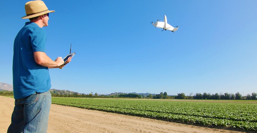
From a standing start the Quantix from AeroVironment reaches for the sky to gather crop information
May 3, 2017
I'm still working through a pile of information I've gathered at the National Farm Machinery Show and Commodity Classic, which given my schedule probably means I'll be 'parsing' information on tech and ideas for months to come. One product I've wanted to write about is a new kind of drone from a company that has some history in the defense industry - Aerovironment.
This company is essentially coming to the ag market ready to rock and roll with a new kind of drone - the Quantix. There are a range of platforms out there from the hovering multi-prop copter style machines made popular by DJI and others, to fixed wing planes that can cover a lot of territory on a charge. How about a machine that lands and takes off like one, but flies like the other?
One of the challenges of using a drone is the system itself. Setting up the path, gathering the information and then putting the information to use can be time-consuming. And in some cases is not for the faint of heart.
Matt Strein, who spoke during a Farm Industry News seminar on Aerial Imagery, is director, business development, Aerovironment. He shared that the company's system is easier. "You can plot the flight, and once that's in the system, all you have to do is verify that the air is clear and hit 'go' and the drone does the rest," he said.
The Quantix sits upright, but moves to level flight when it reaches altitude. The unit, when charged, can cover 400 acres in a flight. And once on the ground all the information is available right away - without the need for internet access. Essentially all you do is set it on the ground, make sure you've uploaded your path information, cleared the airspace and initiate 'go' from your smart phone. The Quantix hits the air (see video at the end).
Strein added that people don't want to be drone experts. The airship can capture both visual and multi-spectral imagery at the same time. And you can manage the information using tablet-based software. You can also analyze information on a desktop version too.
What sets this unit apart is that airship design. The machine has a wingspan of just over 3 feet reinforced with a carbon fiber spar. The unit weighs about 5 pounds, and the company promotes this unit as being built for the farm.
Images are captured by two 18 megapixel cameras and sensors - that's pretty high rez. The company claims 1-inch RGB resolution for visual images and 2-inch resolution for near infrared at 400 feet. At those resolutions, you can start to gather some interesting information.
Row crop farmers see the potential value in drones. Aerovironment is also involved in an interesting study with Fresno State University to better understand the correlation between aerial multispectral data and hydration data related to water stress in almond trees. Gathering the information is one thing, making sense of it is another. That's the point of this work.
The drone industry continues to evolve. The folks at Aerovironment are obviously providing a very different approach to gathering the data; and bringing it together with a high-end package of software. You can learn more at avinc.com.
You May Also Like
Enter a zip code to see the weather conditions for a different location.


