The initial “gee whiz what a great idea” phase of unmanned aerial vehicle introduction has abated, somewhat, leaving the folks genuinely interested in using the technology for commercial endeavors now asking: “How will this amazing technology help me run my business?”
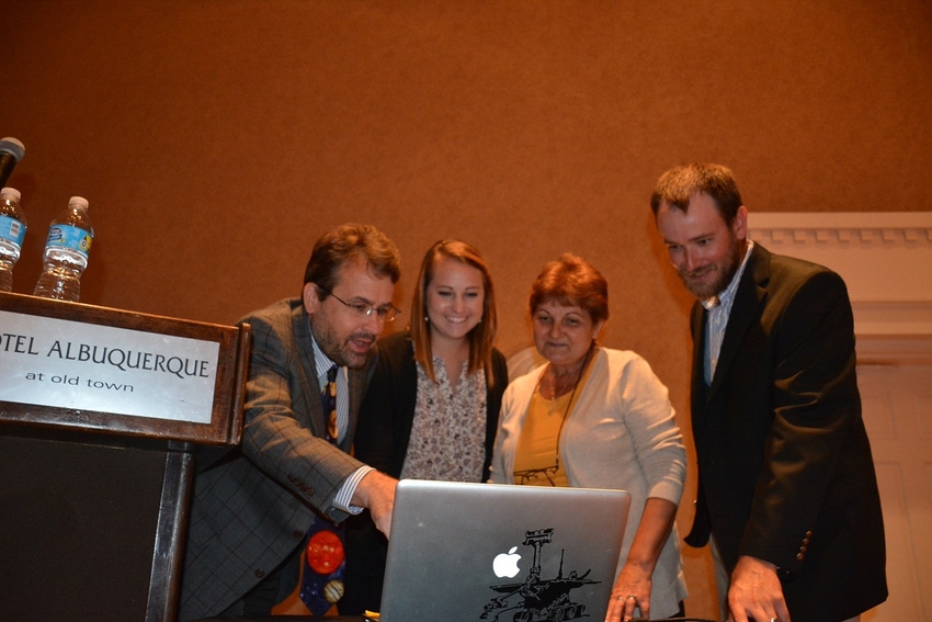
A panel of researchers discussed possible applications for UAS—unmanned aerial systems—at the recent American Peanut Research and Education Society (APRES) annual meeting in Albuquerque. Panelists Jamey Jacob, Oklahoma State University; Sarah Pelham, University of Georgia; Josh McGinty, Texas A&M AgriLife; and Maria Batola, Virginia Tech, agreed that unmanned aerial vehicles—drones—are capable of “taking pretty pictures,” but that extracting useful data from those images requires a bit of tedious work and ongoing study into how to collect and use data.
“Collecting data is a piece of cake,” Batola said. “We get beautiful pictures in 10 to 15 minutes, but it may take several hours to analyze the data from those images.”
And data, she said, is the reason to fly the drones. “Big data is a big deal. We want to develop phenotyping tools to aid plant breeders and to develop remote sensing tools to benefit agricultural producers.”
Batola says ag research has used ground unit remote sensing tools for years. “Now, we want to compare those with UAS.”
PRACTICAL APPLICATION
She said remote sensing studies at Virginia Tech have included efforts to estimate yields and to develop a nitrogen stability index. “We want to improve nitrogen management in wheat,” she said.
She’s looking at drought stress research in peanuts, evaluating various genotypes to observe wilting, yield and mature kernel potential, and crop values. “We want to find coefficients of correlation,” Batola said.
Pelham, a graduate student at the University of Georgia, is evaluating disease and phenotype relationships in peanuts “using unmanned aerial systems.” Tomato spotted wilt virus is a key disease target. She’s also looking at leaf spot and nematodes. “We want to use UAS to identify areas in the field with nematode infestations.”
She says different peanut genotypes show “different spectral signatures with different colors in the field.” Some varieties may be greener than others, for instance.
Drones also help evaluate stand count. “We can evaluate stands and determine a threshold for replant,” she said, “and we can determine where stands are thin and replant only those areas.”
Evaluating and predicting yield, she said, is another potential objective for UAS.
SYSTEMS EVOLVING
Jacob says making UAV technology an integral part of commerce has “a long way to go. The period of hype that comes with introduction of new technology does fade as some lose interest and some disillusionment sets in.” The task now, he said, is to find how to use UAS in a productive way.
The adoption will come, he added. “The current (younger) generation will be the last to get a driver’s license.” Driverless vehicles will become normal, he said. “Millennials, instead of having texting distract them from driving will think driving distracts them from texting.”
Agriculture, he added, will offer a big market for UAV use. “In Japan, UAVs have proven useful on small farms for spraying and other tasks.” Widespread use for more than imaging could be more problematic for large-scale farms. Potential uses include crop monitoring, chemical applications, and airborne imagery. But cost could be a factor. Manned aerial vehicles could, in some cases, be a better choice. Imagery would be takes from as high as 10,000 feet with a manned aircraft, he said. “UAVs have higher resolution, but do you need it? A lot depends on the cost and the crop value and what you need from the imagery.”
Jacob said UAVs will improve and find more uses. With normalized differentiated visual imagery (NVID) producers can identify areas of vegetation that are healthier than other areas. “We can get biomass estimations with added sensors and perhaps estimate crop yields. Plant diagnostic capabilities may improve to being capable of collecting data associated with a single plant.”
He said automated weed databases will be configured to send data to automated ground vehicles that will target sprays.
REGULATORY ISSUES
Jacob says regulations continue to limit some uses. For instance, users currently have altitude limits and must keep the UAV in sight, which requires someone on the ground to monitor the vehicle. That could change in the future to allow a user to monitor and control a unit from an office, collect data, process with a computer and take action from the information collected—without leaving the desk.
Challenges with that system include increased risk, insurance options and safety precautions.
He said technology is getting cheaper, but cost will be driven by the application and the size needed to perform certain tasks. A vehicle capable of spraying, for instance, would be heavier, and more expensive than a small rotor drone that mostly takes photos.
McGinty says in the future, UAS will be used to collect field data and use it for decisions or to evaluate research efforts. “We will collect and process data and determine what information will be useful and how best to use it. That’s the goal, but we’re not there yet.”
He’s using mostly rotor units for crop research evaluations, and fixed-wing for some pasture and rangeland studies. Fixed wing, he said, covers more area.
In research plots, he’s using drones to check plant growth, including plant height and canopy cover. Assessing plant health with NDVI is also a possibility. “We want to be able to use UAS data to predict yield,” he said. Drones are evaluating plant height and boll and bloom counts in cotton. “Boll counts have proven to be of less value than we anticipated,” he said. “But we are looking at different ways to use that data.”
He said looking at bloom counts may help identify stressed plants.
He’s also looking at sorghum. “We can collect images of sorghum panicles, but we have to count by hand. We want to automate that. But even having to do counts manually in the office is better than counting in the field in the heat and humidity of Corpus Christi.”
He said research on sorghum is in early stages. “We have only one year of data.
PROCESSING PROBLEMS
“Our biggest struggle so far is in sharing data,” McGinty said. “After collecting data, we may spend from eight to 12 hours processing it.” Going through a UAS Hub located at College Station streamlines the process.
The initial hype, Jacob says, has diminished. Regulations remain in place with the FAA still in control of drone flights, but rules are under review as more units are put in use and as technology improves control.
The key to making a drone a useful tool for agricultural research and for on-farm applications, the four researchers said, is to find ways to put the collected data to use in decision making. Data is the crucial factor, and the technology is not available yet to collect, process and use the information efficiently.
“Big data is essential for crop use,” Jacob said. “We can take pretty pictures, but we’re not to big data yet.”
About the Author(s)
You May Also Like


