Subscribe to receive top agriculture news
Be informed daily with these free e-newsletters

Dry weather continued in the Midwest this past week.
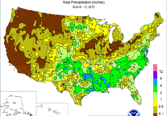
Rainfall expanded and intensified from the central and southern Plains eastward into the middle and southern Atlantic States, providing abundant to locally excessive moisture for pastures and immature summer crops.
Flash flooding struck several areas, including portions of the southeastern Plains, where late-week rainfall locally totaled 4 to 8 inches or more. The heaviest rain fell along and near the leading edge of cooler air. As a result, the deepening cool pattern across the central and eastern U.S. held weekly temperatures at least 5°F below normal across large sections of the Plains and Midwest. East of the Rockies, lingering heat was mostly limited to Florida’s peninsula and southern Texas. Meanwhile, most of the Midwest received little, if any, precipitation. Of particular concern for corn and soybeans were areas—such as large sections of Iowa and northern Missouri—that have received minimal rainfall in recent weeks.
Farther north, however, beneficial showers peppered the far upper Midwest. Spotty but much-needed rain also dampened drought-affected areas of Nebraska and the Dakotas, but largely bypassed parched Montana.
You May Also Like
Enter a zip code to see the weather conditions for a different location.