March 5, 2018

The climate behavior so far in 2018 has been highly variable, with wide variation in both temperature and precipitation across Minnesota.
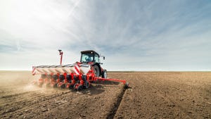
April is a critical month for agriculture in Minnesota. Soils have typically thawed and warmed enough for planting, often by the last two weeks of the month. Many Minnesota farmers are anxious to take advantage of early fieldworking opportunities when the weather permits, so farm equipment is usually tuned up and ready to go by the first week of April. However, I suspect the high variability in the climate from the first three months of the year will continue in April.
Occasionally, all the pent-up ambition to get started with fieldwork is stymied by frequent and abundant April snows, as it was in 1983, 2008 and 2013. There can also be wild swings in the weather patterns during April in terms of temperature and rainfall.
Weather extremes in April have been very wide-ranging over the course of history. It has been as hot as 101 degrees F, which happened April 22, 1980, at Hawley in Clay County, and as frigid as -22 degrees F, which occurred April 6, 1979, at Karlstad in Kittson County. Rainfall extremes, too, are very wide-ranging, with virtually no rainfall for the entire month being reported for northwest Minnesota (Ada, Crookston, Thief River Falls and Halstad) in 1980, while more than 8 inches of April rainfall was reported at Canby, Marshall and Worthington in 2001. In fact, on April 23, 2001, many parts of the state saw more than 4 inches of rain from just one thunderstorm.
Precipitation, temperatures sometimes work together
Oftentimes, the patterns of temperature and precipitation in April are coupled, but in subtle ways. For example, the very hot days with daytime highs from 80 to 100 degrees F that repeatedly occurred in the Aprils of 1910, 1931, 1980 and 1987 were associated with prolonged high pressure, clear skies and absence of precipitation. The warm Aprils of 1985, 1986 and 1991 also brought high daytime temperatures. Yet more significantly, they also brought very warm overnight temperatures, with lots of cloudiness, high dew points in the 60s, and rain — which produced very wet field conditions for trying to plant crops.
Then again, sometimes these coupled temperature and precipitation patterns can change overnight during April. One day it can feel like June and the next day, more like January.
This was the case at Lamberton in Redwood County over April 2-3, 1982. The afternoon of April 2, the temperature rose to 78 degrees F and dew points were in the muggy 60s. The National Weather Service issued a severe thunderstorm watch and a tornado watch for the late afternoon and early evening. Then a line of thunderstorms passed through ahead of the cold front, bringing nearly an inch of rain, but no tornado. The cold front dropped the temperature to just 7 degrees F by the morning of April 3, with a dew point of 0 degrees F. That was a 71-degree-F temperature change in less than 15 hours.
The way Minnesota temperature patterns have been erratic this year, I would not be surprised to see some very wide variation in temperature during April 2018 — and perhaps some significant thunderstorms as well. Hopefully, there will also be some early fieldworking opportunities for farmers, who undoubtedly will be ready to go when the weather permits.
Seeley is professor emeritus of climatology from the University of Minnesota.
About the Author(s)
You May Also Like


