July 7, 2017

Some of the heaviest rainfall every recorded in Minnesota history occurred Aug. 18-20, 2007, across the state's southern and southeastern counties.
A series of thunderstorms moved along a stalled warm frontal boundary over the Iowa-Minnesota border during that period, generating multiple heavy downpours — some of which lasted for hours. Many observers reported 12 to 14 consecutive hours of heavy rain over Aug. 18 and 19, with accumulation rates of more than 1 inch per hour at various times.
Multiple records set
Rainfall totals set all-time daily records in many areas, especially southeastern counties.
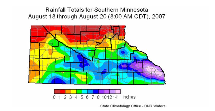
Some of the records set on Aug. 19 included 15.10 inches at Hokah in Houston County; 11.45 inches at Altura, Winona County; 8.8 inches at Elgin, Wabasha County; 8.5 inches at Dodge Center, Dodge County; and 7.4 inches at Montgomery, Le Sueur County.
Multiday totals also set records across southern Minnesota, with totals ranging from 10 to 16 inches across portions of Houston, Winona, Wabasha, Olmsted, Dodge and Fillmore counties.
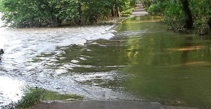
Almost all major roads and highways were blocked by flash flooding. The Cannon, Root, Whitewater and Zumbro rivers all reached record flood crests, and the town of Rushford in Fillmore County was nearly completely flooded for days, with travel possible only by canoe or boat. The route of the Whitewater River through the state park was changed considerably due to the deposit of large quantities of rock and gravel, which wiped out many campgrounds there.

RECORD RAINS: This Minnesota map of the southeast portion of the state shows the average record-setting rainfall that fell in mid-August 2007.

Major erosion
Agricultural erosion on the sloped fields of southeastern Minnesota was enormous, with huge ditches and gullies created by the runoff. It was overall an extremely wet month, with some climate stations reporting measurable rainfall on over half the days of the month.
More than 135 new daily rainfall records were set within the Minnesota climate observer network during the month.
Additional thunderstorms over Aug. 21 to 31 caused even more erosion, and brought new monthly record rainfall totals to many areas. Some of these record values included 23.86 inches at Hokah; 19.87 inches at Spring Grove in Houston County; 18.96 inches at Caledonia, Houston County; 18.84 inches at Winona, Winona County; 18.41 inches at Altura; and 14.07 inches at Rochester, Olmsted County. In many cases these numbers not only represent the wettest August in history, but also the wettest single month in history as well.
In the aftermath of this historic flash flood, many farmers revamped grass buffer strips and revised contour plowing. Some counties deployed larger culverts as they replaced bridges, and some communities increased the capacities of their storm sewer runoff systems.
Seeley is an Extension climatologist with the University of Minnesota.
About the Author(s)
You May Also Like


