June 21, 2012

Extreme drought has crept back into Arkansas, according to the U.S. Drought Monitor map released June 21.
Drought now covers 99.71 percent of Arkansas, with just a small portion of southeastern Columbia County on the Louisiana border remaining free of any drought category. A year ago, drought covered nearly 83 percent of the state.
The “extreme” classification, the second most severe category, covers part of northeastern Clay County.
Most of the state is classified as “severe,” with pockets of less-severe drought in Benton and Washington counties, Columbia and parts of its neighbors, Lafayette, Nevada, Ouachita and Union counties; parts of Desha, Chicot and their neighbors, Arkansas, Ashley, Drew, Monroe, and Phillips counties; and nearly all of Mississippi County.
A PDF of the map can be found here.
With highs in the 90s over the past week and more in the forecast, “The heat is back and appears with some intensity,” said Brent Griffin, Extension staff chair in Prairie County. “Much of the corn acreage in Prairie County is at the ‘roasting ear stage’.”
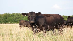
The drought may also mean a role reversal for Arkansas’ hay growers. Last year, many sold hay to cattle producers in Texas and Oklahoma.
“It looks like the Sahara Desert around here,” said Jesse Bocksnick, Sebastian County Extension agent. “At the end of May, the grass should’ve been ripe and green. It looks more like the end of August.
“This year, I have had out-of-state producers sending me contact info wanting to sell here -- mostly from Oklahoma,” he said. “If it doesn't rain, we may be the ones paying big for hay or selling our cattle.
Fire has been another byproduct of the dry weather. The Arkansas Forestry Commission reported June 20 that its crews had suppressed 10 wildfires covering 74 acres and were working to contain four more fires.
The forestry commission lists the wildfire danger as moderate for nearly all of the state except Cleburne, Columbia, Conway, Faulkner, Hempstead, Lafayette, Miller, Nevada, Ouachita, Perry, Pulaski, Union, Van Buren and White counties.
For more, see here.
Burn bans have been enacted nearly half of Arkansas’ counties: Clark, Cleburne, Cleveland, Conway, Faulkner, Franklin, Fulton, Garland, Hempstead, Howard, Independence, Johnson, Lincoln, Logan, Madison, Marion, Montgomery, Nevada, Ouachita, Perry, Pike, Pope, Polk, Pulaski, Scott, Sharp, Stone, Union, Van Buren, White, and Yell counties.
For more information on crop production or water conservation, visit www.uaex.edu or contact your local county agent.
You May Also Like


