Mississippi State University wins competition to lead national UAV research effort
The National Center of Excellence for Unmanned Aircraft Systems at Mississippi State University is expected to begin research in September, with a “fully operational, robust research agenda by January 2016.”
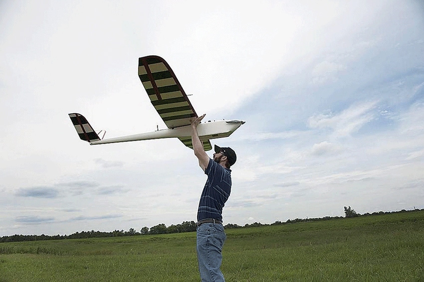
Mississippi State University has been selected to lead a consortium of 13 universities in operating a national center for research on unmanned aircraft systems (UAS), encompassing a wide range of applications, from agriculture to homeland security.
The National Center of Excellence for Unmanned Aircraft Systems is expected to begin research in September, with a “fully operational, robust research agenda by January 2016,” the university said in a statement following the announcement by the Federal Aviation Administration.
Included will be research into drone detection and avoidance technology, low level flight safety, control/communications, pilot training, and integration with air traffic control systems.
The FAA announcement signaled the culmination of a “hard-fought competition to host the nation’s premier civilian academic center focused on research and policies related to unmanned aerial systems,” said U.S. Sen. Thad Cochran, R-Miss.
He said he was notified of the decision by U.S. Transportation Secretary Anthony Foxx.
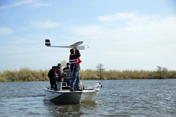
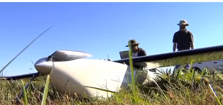
AN UNMANNED aerial vehicle is prepared for launch in St. Tammany Parish, Louisiana. Researchers with Mississippi State and NOAA are mapping sections of the Pearl River with the UAV to better understand where and how much water flows through the area and the impact it can have on local communities when hurricanes and other tropical weather systems develop.—Photo: Jim Laird
“Mississippi State University and our state have a wonderful opportunity to use their research expertise and unique facilities to advance and influence all aspects of the unmanned aerial sector, from national policies to deployment to manufacturing,” Cochran said in a statement.
“Unmanned systems are here to stay, and this national center will help to insure that they are used to improve American security and productivity, while protecting privacy.”
The directive to the FAA to establish a national center has been included in congressional appropriations bills since FY2012, with Congress providing $1 million for the effort in FY2014 and $5 million in FY2015.
Sen. Cochran and others of the Mississippi delegation — Sen. Roger Wicker and Rep. Greg Harper, both R-Miss. — have been working more than four years to secure the center for their state.
Stay current on what’s happening in Mid-South agriculture: Subscribe to Delta Farm Press Daily.
“Mississippi is on the cutting edge of unmanned aircraft technologies,” Wicker said. We’re home to some of the world’s leading aerospace companies and research universities, and in the field of unmanned aircraft systems, Mississippi State University is second to none.
“This announcement insures that our state will continue to be a critical hub for advancing aerial technologies, which can help to improve our ability to grow crops more efficiently, respond to humanitarian crises, and better protect our troops.”
UAS technology is no longer in its infancy, he said, “but we’re still just scratching the surface of what can be accomplished with these systems.”
Leading aerospace engineering center
Mississippi State University’s Department of Aerospace Engineering is consistently ranked among the best in the nation, attracting students worldwide. Its Raspet Flight Research Laboratory is one of only a handful of university-based flight laboratories in the nation where students can conduct research involving the analysis, design, manufacture, and flight testing of full-scale aircraft and unmanned aerial systems. It boasts access to some of the best computational resources in the world through its affiliation with MSU’s High Performance Computing Collaboratory.
It’s expected that the MSU research will involve work with the Raspet laboratory on the Starkville campus, the Stennis Space Center in Hancock County, and at sites in the Mississippi Delta related to precision agriculture systems.
“This has been a six-year effort for Mississippi State University and three years for our partner universities,” said retired U.S. Air Force Major General James Poss, former assistant deputy chief of staff for intelligence, surveillance, and reconnaissance, who researches UAV issues at MSU.
He also heads the Alliance for System Safety of UAS Through Research Excellence (ASSURE) team, which is charged with helping the FAA develop ways to safely integrate UAVs with manned aircraft.
“We expect this team will help us to educate and train a cadre of unmanned aircraft professionals well into the future,” said Transportation Secretary Foxx.
MISSISSIPPI STATE UNIVERSITY'S Geosystems Research Institute is working with agronomists to incorporate the use of unmanned aerial vehicles in site-specific agricultural research.—MSU photo
MSU is the only university in the state that already holds an FAA certificate to operate UAVs.
Projections by the Association for Unmanned Vehicle Systems indicate that the industry could generate more than 100,000 jobs, with an economic impact of $82 billion, in the first decade after the FAA permits normal commercial operation of UAVs.
The use of unmanned air systems in non-conflict situations is growing, with applications well-suited for natural disaster response, humanitarian relief efforts, environmental impact assessment and precision agriculture, according to David Shaw, MSU's vice president for research and economic development.
"We are well positioned to expand our significant role in unmanned aerial systems research and development, as well as manufacturing, here in Mississippi and around the country with our ASSURE partners." The university's collaborative approach to research and "real world" impact are keys to its growing research enterprise, Shaw said.
For the past decade, the Raspet Flight Research Lab has served as a start-up facility for various aerospace companies in the state, he noted, providing workspace, technical training, and assistance with product development and research. Those efforts and Mississippi State researchers' expertise have helped companies such as American Eurocopter, Aurora Flight Science, GE Aerospace, and Stark Aerospace establish bases in Mississippi, bringing more than 700 high-tech jobs to the state.
Precision agriculture applications
The university's scientists are also using UAS as another remote sensing tool available to collect visual and multispectral data.
"Precision agriculture is data driven, and UAS technology adds another significant layer of data for researchers, and ultimately crop consultants and producers, to assess and utilize in a meaningful way," said Robert Moorhead, the director of the MSU Geosystems Research Institute.
In a 2014 agriculture research study focusing on plant growth, GRI worked with Brien Henry, MSU plant and soil sciences associate professor to use UAVs to collect plant population data, including details on emergence progress, number of plants per acre, their heights and number of unfurled leaves, leaf-area indexes, and growth stages.
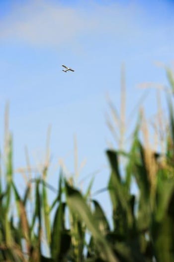
A FIXED-WING unmanned aerial vehicle flies above a research plot of corn at Mississippi State's R.R. Foil Plant Science Research Center. MSU's Geosystems Research Institute collaborates with university agronomists on several projects involving the use of unmanned aerial systems in precision agriculture.—Photo: Beth Wynn
It was the first time UAV technology was used to augment research on the ground. "They were flying overhead and collecting visual and multispectral data," Henry said, and at the same time, the ground team was analyzing the data "to insure that images from above were what we were actually seeing on the ground."
A primary goal of his research, he said, is the development of automated computer programs that can recognize individual seedlings and quickly and accurately determine plant density across a planted field. Spatially-explicit maps of plant population would allow producers to make timely and informed decisions about replanting.
Henry said UAVs can zoom in to approximately one-eighth inch, while planes and satellites are limited to collecting images at resolutions of only about 18 inches. Also, UAV images may be collected during inclement weather conditions, and just one UAV can cover approximately 1,000 acres in an hour.
UAV use will be among the subjects taught in a new agriculture partnership recently announced between MSU and Mississippi’s Hinds Community College.
The program will provide students opportunities to learn about cutting-edge technology — including UAS — and prepare them for leadership roles in 21st Century agribusiness.
As part of the partnership, Hinds will offer two options with the completion of the Associate of Applied Science degree — one allowing students the opportunity to go directly into the workforce, a second offering the option of transferring to Mississippi State with 60 hours of community college coursework toward a bachelor's degree in agricultural engineering technology and business, with a concentration in precision agriculture.
“Our students will be able to enter the workforce immediately, if they so desire, and will have the hands-on skills that they need to contribute productively to the vital Mississippi agricultural industry," said Hinds President Clyde Muse. ‘We are also pleased they will have the option of continuing their education for a bachelor's degree that will further strengthen their training."
Hinds Community College's aviation department is headquartered at John Bell Williams Airport near the Raymond Campus, which is the only airport in Mississippi owned and operated by a community college.
The existing aviation program includes commercial aviation, aviation maintenance technology and aviation technology. Aviation technology has four programs: air traffic control technology, airport operations and aviation security technology, all based on the Rankin Campus, and unmanned aerial systems, based at the airport.
Identifying critical issues a program goal
ASSURE, the consortium of universities across the country, will work to identify issues critical to the safe integration of UAVs into the nation’s airspace, and engage in research and policy development on the expanding use of unmanned aircraft.
As directed by Congress, the FAA selected a host for a center that will also conduct research related to the deployment of UAVs for emergency response, maritime contingencies, biofuel and clean fuel technologies, law enforcement, and agricultural and environmental monitoring.
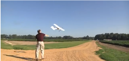
A UAV is launched to survey crop fields.—MSU photo
Among other responsibilities, the center will coordinate research and development activities with the National Aeronautics and Space Administration, Department of Defense, Department of Homeland Security, Department of Agriculture, and other agencies.
It is expected that its work will lead to recommendations related to aircraft certification, flight stands, and air traffic requirements, as well as facilitating UAS technology transfer to other civilian and defense agencies.
Members of the ASSURE consortium are Mississippi State University, Drexel University, Embry-Riddle Aeronautical University, Kansas State University, Montana State University, New Mexico State University, North Carolina State University, Oregon State University, University of Alabama-Huntsville, University of Alaska-Fairbanks, University of Kansas, University of North Dakota, Wichita State University, Auburn University (associate member), Concordia (associate member), Indiana State University (associate member), Louisiana Tech University (associate member), Tuskegee University (associate member), and University of Southampton (associate member).
About the Author(s)
You May Also Like
