1 Min Read

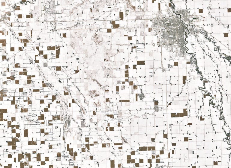
SATELLITE’S-EYE VIEW: Pictures of North Dakota taken recently by the Landsat 7 satellite show some of the estimated 1.88 million acres of corn left in the field throughout the state.Getty Images
The ability to use photos taken by drones, airplanes, helicopters and satellites keeps gets getting more exciting. You can scout fields, count plant populations, monitor crop stress, track cows, check water tanks and even spot spray weeds.
The latest? Seeing unharvested cornfields from space!
Pictures of North Dakota taken recently by the Landsat 7 satellite show the brown fields of corn standing out in stark contrast to the white snow. A NASA Earth Observatory photo of northeastern North Dakota (Grand Forks in the upper right) was recently published by Atlas Obscura.
 BROWN FIELDS: Brown, unharvested corn fields in North Dakota stand in sharp relief against the snow.

It’s estimated that there are 1.88 million acres of corn left in the field in North Dakota.
About the Author(s)
Subscribe to receive top agriculture news
Be informed daily with these free e-newsletters
You May Also Like


