
Subscribe to receive top agriculture news
Be informed daily with these free e-newsletters
May 20, 2014
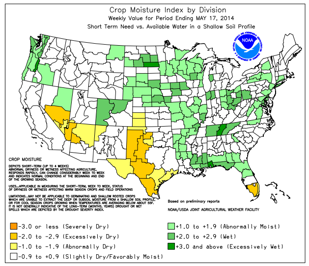
Heavy rain preceded and accompanied a late-season surge of cool air. Most of the eastern half of the nation received at least an inch of rain, with 2-4-inch totals common from eastern Texas into the central and eastern Corn Belt and in the Atlantic Coast States. The rain curtailed fieldwork across much of the Midwest, South, and East, following a warm, dry period that had favored a rapid planting pace.
In the rain’s wake, chilly air blanketed the nation’s mid-section. Weekly temperatures averaged at least 10°F below normal across portions of the April continued to exhibit the regional variability that has been the hallmark of the 2013-14 winter wet season. By month’s end, the sharp contrast in snowpack persisted, with northern and eastern parts of the West reporting abundant moisture, and southern and western areas having meager accumulations.
Reservoir storage was below average for this time of year in all states except Montana. By early May, the 2013-14 wet season had effectively ended in drought areas from California to the southern Rockies. Despite a few April showers, runoff prospects remained bleak in California, the Great Basin, and parts of the Southwest.
All graphics courtesy of USDA, NOAA, Department of Commerce
Read the full WAOB report from USDA.
You May Also Like
Enter a zip code to see the weather conditions for a different location.


