Mike Starkey, Brownsburg, Ind., loves to bring other conservation farmers like himself together to hear about innovative topics and to share thoughts about what works and what doesn’t. Before sending them home, he leaves them with one thing he has learned that works on his farm. He calls it sharing his “aha!” moment — that instant when everything clicks and an idea makes sense.
For the past couple of seasons, Starkey has worked with a service called AirScout Thermal Imaging, obtaining images of his fields from airplane passes at key times during the season. He’s gained enough confidence in what this is helping him do that he shared it as his “aha!” moment at a recent field day at his farm in March.
“My theory is that it doesn’t make sense to fertilize every part of the field the same if every part will not yield the same,” Starkey says. “I want to maximize dollars I am investing in nitrogen by putting them where they will help yields the most.”
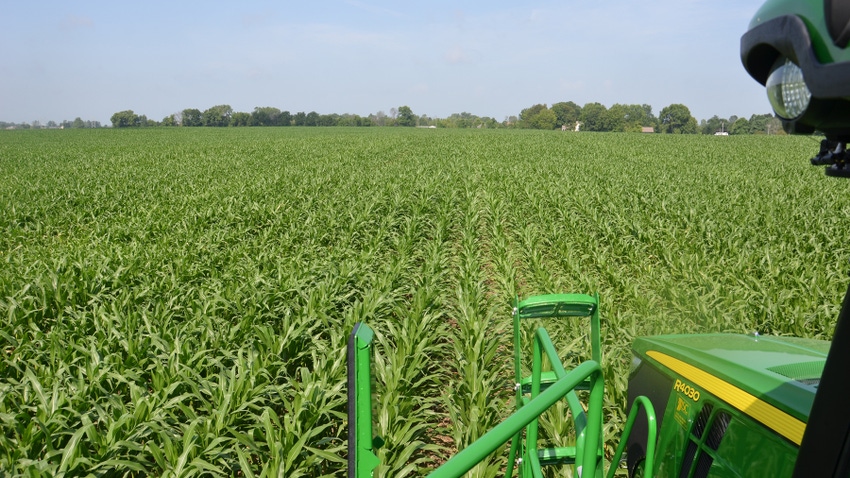
Many people set up management zones based on soil types and yield maps, perhaps tweaked by looking at additional factors. When it comes to varying nitrogen for corn, Starkey prefers getting a bird’s-eye view of the crop as it grows just before he is ready to apply his last shot of nitrogen. His sprayer is equipped with Y-drops, and he makes the application somewhere around V10 to V12, or later if necessary.
Aerial view
Starkey contracts with AirScout Thermal Imaging, a scouting service that provides 11 flights over his fields at key times during the season. “What I really like is the quick turnaround time,” he says. “I usually get images the next day.”
Images depict crop health. He can download them through an app on his phone, so he can view images of his fields wherever he goes. Once images arrive, Starkey uses software provided by AirScout to make prescription maps. Mark Truster of Reynolds Agronomy sends those prescription maps for nitrogen application to the cloud and then to Starkey’s sprayer via the John Deere Operations Center.
“We may go 30 or 35 gallons of liquid N where imagery says the crop is really good,” he says. “Where it’s OK but not quite as healthy, we might apply 5 gallons per acre less. Through the prescription map for each field, changes are automatic.
“As I go through the field, I may notice a really good area of corn. Sure enough, I check the monitor, and the sprayer is applying at maximum rate. If I move into an area that is not as good, I look at the monitor again and it has dropped the rate.
“We really feel like it is making a difference on our bottom line. We’re putting nitrogen where corn can best use it, and it appears to be paying off at harvest.”
AirScout Thermal Imagery is based in Champaign, Ill. It was founded in 2010 by Brian Sutton. He and his brother, Dan, farm near Lowell, Ind. Learn more at airscout.com.
About the Author(s)
You May Also Like


