September 1, 2020

The use of aerial imagery to track crop progress and health is becoming more common across the country. Makers of unmanned aerial imagery equipment and software are fine-tuning their approaches, which aim to make it not only easier to capture information but also interpret what you see in the field.
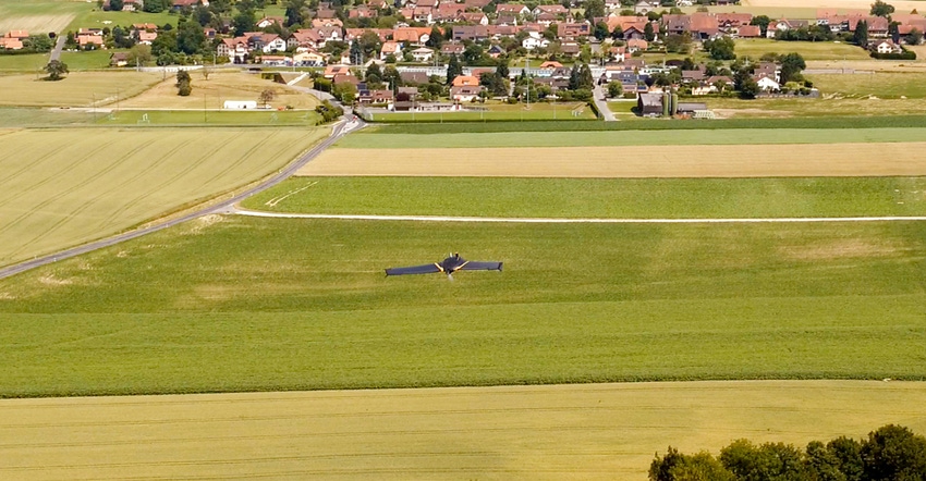
Farm Progress caught up with SenseFly, a software provider for drones that’s been in the air for more than a decade. Noted for the eBee fixed-wing airship, the company also makes and markets proprietary software to fly the machine and capture information.
“I think one of the big things when you look at the drone landscape is experience," says Troy Hittle, general manager for North America, SenseFly. "But what drew me to SenseFly is that the company is solution-focused.”
While the eBee airship may be familiar, the factor that’s setting aerial imagery companies apart is their software. Hittle notes that SenseFly has built its own autopilot and mission-planning software that can use company sensors or integrate with other image capture tools. “We’re not relying on third-party solutions,” he adds.
One question that’s evolving in the country is who will run the drone. Many software companies point to the fact that this is changing — with agronomists taking on that role since the airships can help them cover more acres for accurate scouting. But that doesn’t mean farmers can’t run their own.
“In my experience,” Hittle says, “we see more agronomists who the grower is listening to and trusting to get insights on the next move for a crop. [Farmers] are always looking for a better way to get information.”
Yet, Hittle sees more agronomists taking on this role, and that increases the need for the airship to cover more territory in a day. “The learning curve for [operating a drone] is not as steep, and the reason is the automation,” he says. “With the SenseFly eBee, the light goes on, you do two or three things to get set up and throw the drone in the air. The rest is automatic.”
On a mission
Hittle is adamant that a key value for the right drone software is mission planning. “For every amazing thing a drone can do, it doesn’t mean a thing if the mission planning software is in Greek,” he says. The key is simple to implement software so users can plot that course to get the imagery in the most efficient manner.
For example, the eMotion system developed by SenseFly allows you to plan an entire flight and collect data efficiently. How has that changed?
“What used to take hours is now done in minutes," Hittle says. "We can run 500 acres and have the processing of the images done in less than 10 minutes." And the scout can look at that imagery at the edge of the field. If there's a trouble spot they can walk to the area of the field in question right away.
Those high-resolution images which can include RGB (visual) images can show stand counts and crop establishment, multi-spectral imagery can show you crop health and the basis for those normalized differential vegetative index maps that have become popular. But Hittle says there's another area of growing interest and that's thermal imagery.
"Thermal imagery not only provides a great picture, but at the end of the day crop science is evolving," Hittle says. For example, a thermal image of a crop at night can show if natural processes are happening in the crop. For many crops, the "open up" at night to respirate or breathe. He notes that an agronomist can study thermal imagery and one plant may be cool but one farther down the row may be warmer.
"It's staying closed at night, perhaps to reserve water,” Hittle notes. “Why is it doing that? Is there a water table issue? We’re providing that kind of insight.”
He explains the company’s sensor optimized for drone applications (SODA) sensor can be paired with an industry-standard FLIR (forward-looking infrared) camera to capture thermal imagery. “You can capture thermal imagery and geo-rectify that with the high-resolution imagery [from the SODA] as the anchor,” he says.
Every aspect of farm data-gathering is changing, often with a path toward providing farmers enhanced management information. Easier capture of that information is possible as software and scouting evolve.
More multispectral and hyper-spectral imagery in the future will be able to provide agronomists and their farmer-customers even deeper insight into ways to maximize crop performance.
About the Author(s)
You May Also Like


