Subscribe to receive top agriculture news
Be informed daily with these free e-newsletters

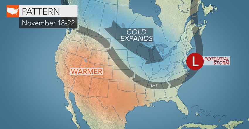
A polar vortex could dump cold weather on the Upper Midwest and Northeast before Thanksgiving.
Chop, split and lay in more firewood this week. AccuWeather meteorologists warn another polar vortex may be freight-training south and east from the Arctic Circle.
One such blast is already sweeping into the Upper Midwest and Northeast, says Paul Pastelok, AccuWeather’s lead long-range meteorologist. A second arctic “express” could deliver more snow, rain and wind. He predicts it to arrive beginning this weekend and may slow pre-Thanksgiving travel plans. At the very least, the pattern favors periodic snow, wintry mix and/or lake-effect snow squalls from the Upper Midwest to the interior Northeast.
Eastern dumping ground
When cold air drops southward across the Midwest and into the East, a major storm can be spawned, explains AccuWeather meteorologist Evan Duffey. The Eastern Seaboard is often a perfect breeding ground for storms in situations like this.
“The clash between the arriving arctic air and warm waters of the Atlantic Ocean could help instigate a major storm,” he says. If the storm grabs moisture fast enough, it can produce heavy snows inland and heavy rain and wind on the coast.
Meteorologists headquartered in State College, Pa, say the magnitude and path of the cold air plus its exact formation and track may become clear next week. Based on climatology, accumulating snow is much more likely to occur over the higher elevations from north and west of Interstate 95 to the Appalachians during early winter, due to the relatively warm Atlantic Ocean.
You May Also Like
Enter a zip code to see the weather conditions for a different location.


