The next in a series of winter storms aimed at the West Coast was gathering strength in the coastal Pacific Northwest region on Tuesday morning and was expected to bring widespread rain and snow throughout Northern California, with more possibly coming this weekend, the National Weather Service reports.
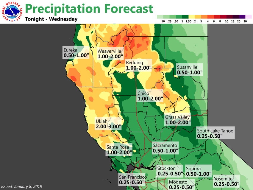
The highest rain totals on Tuesday night and Wednesday were expected to be in the coastal range, northern Sierra Nevada and northern Sacramento Valley, but rain and high winds are predicted in much of the state, according to the agency.
Dry weather sets in for Thursday with the potential for rain and snow again on Friday and Sunday, but models have been shifting the storm track further west, officials say.
Precipitation through Wednesday could reach 3 inches in Ukiah, 2 inches in Redding and Chico and 1 inch in Sacramento, the weather service forecasts.
The latest system follows a big storm over the weekend that forced the closure of Interstate 80 near Lake Tahoe on Sunday, with the freeway reopening Monday. Strong winds and downed trees also knocked out electricity to about 80,000 customers in the Sacramento area on Sunday night, The Associated Press reported.
More snow is needed as California officials’ first manual survey of the year on Jan. 3 found below-average snow-water equivalents in the Sierra Nevada. As of Monday, the snowpack statewide was at 84 percent of average for this time of year, improving from 71 percent a day earlier, according to the state Department of Water Resources.
Many Central Valley communities were still below their seasonal rainfall totals as of Tuesday. Sacramento's 6.18 inches of rain since Oct. 1 was beneath its average of 7.07 inches, while Fresno's 3.19 inches for the season was just short of its average of 3.97 inches, according to the weather service.
About the Author(s)
You May Also Like


