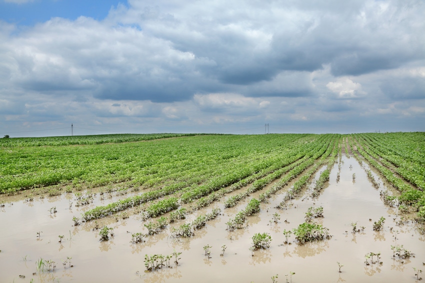
When it comes to crop production, most long-term farm operators are often heard saying that “no two years are the same.” That statement is certainly true in many portions of southern Minnesota and northern Iowa as it relates to the 2018 growing season, in comparison to the previous year. The 2017 crop year featured almost ideal growing conditions across the region, which resulted in record corn and soybean yields in many locations in southern Minnesota and sorthern Iowa. The first half of the 2018 growing season has been much different, with some areas dealing with very late planting, while other portions of the region experiencing continual excessive rainfall and poor growing conditions.
Many portions of southern third of Minnesota and the northern portions of Iowa, as well as southeastern South Dakota received more than double the normal precipitation amounts during June. This trend has continued into early July in some areas. There were also extreme individual rainfall events during mid-June and early July in some locations, which caused considerable drown-out damage to crop fields. Some farmers were able to replant some early varieties of soybeans following the heavy rains in mid-June, only to have some of those replanted soybeans drown-out again after the heavy rainfall events in early July. In addition, there have been some severe storms across the region that have featured hail and wind damage to crops.
Besides the drown-out damage to crops, the continued saturated soils has created a poor growing environment. A major concern that developed as a result of the excessive rainfall levels was the loss or lack of available nitrogen for the growing corn. Soil nitrogen losses increase substantially during heavy rainfall events early in the growing season, such as have occurred in 2018. Corn plants in saturated soils have a much shallower root system and are not able to access the nitrogen that is deeper in the soil profile. In some cases, farmers planned to side dress some nitrogen fertilizer, but were not able to do so due to the continual wet field conditions.
While most locations had above-normal rainfall during June, the monthly precipitation amounts were quite variable across the region. Total rainfall at the U of M Southern Research Center at Waseca in the month of June was 5.78 inches, which was only 1.09 inches above the long-term average June rainfall. By comparison, total June precipitation at the U of M Southwest Research Center in Lamberton was 7.18 inches, which is over three inches above normal. This trend has continued at Lamberton in the first three weeks of July, and total 2018 precipitation since May 1 is now nearly 18 inches, which is almost double the normal growing season precipitation for the first three months.
According to Minnesota state climatology data, county average rainfall amounts for the month of June in most counties in the southern three tiers of counties in southwest and the western portions of south central Minnesota ranged from near 8 inches to over ten inches. This is double or more the amount of normal precipitation amounts for June in these. counties. Most counties in the region had at least one reporting location with 11-13 inches of rainfall during June, and some counties had several reporting locations exceeding 10 inches of rainfall for the month. Many of these same counties in southwest Minnesota have continued to experience heavy rainfall events during July, with extreme flooding in some areas in the first week of July. Some portions of Northeast Minnesota have also had heavy rainfall events in July, which has resulted in some crop damage.
The good news is that crop conditions have improved in southern Minnesota on crops that were not severely damaged by the storms and excessive rainfall. The soybeans seem to have showed the greatest improvement; however, there are also many corn fields that look much better than they did a few weeks ago. For many producers in the hardest hit areas of Minnesota, Iowa and South Dakota, they will likely have a wide-range of corn and soybean yields this Fall from farm-to-farm and field-to-field. Crop conditions in central and northwest Minnesota, along with portions of southeast Minnesota are mainly good-to-excellent for late July.
One thing that has benefited crop development in 2018, as well as helping compensate for later-than-normal planting dates in some areas, is the above normal growing degree units (GDUs) since May 1. A total of 1,498 GDUs had been accumulated at the U of M Research Center at Waseca from May 1 through July 18. The 2018 GDU total is about 20 percent above the normal GDU accumulation for July 18, which is comparable to average GDU accumulation for July 29. This has allowed most of the corn in the region to tassel and pollinate under fairly low stress conditions, other than the excess moisture in some areas.
About the Author(s)
You May Also Like


