October 22, 2019

“It seems like we’ve been getting three-day periods of Indian summer-like conditions, followed by two days of rain and two days of drying. Then we are harvesting until 2 o’clock in the morning,” Joe Farrell says.
The northwest Iowa farmer, near Spencer, says he’s navigating around wet spots in soybean fields. “We did get some beans harvested last week, and they’re yielding good considering the year we’ve had. Early-planted bean yields are averaging in the mid- to upper 50s.”
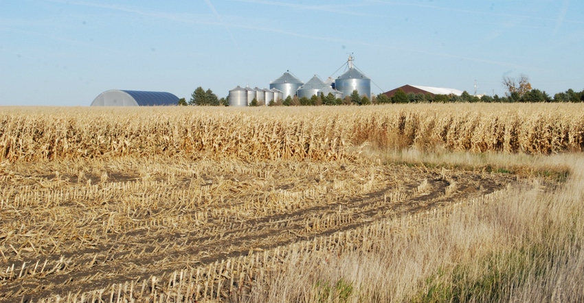
Corn is drying down slowly in Clay County, he says; however, he expects farmers to start harvesting corn and stay with corn until bean fields are fit to enter again. The latest USDA weekly survey issued Oct. 21 shows northwest Iowa 19% harvested on corn. North-central Iowa is only 13% harvested, northeast and west central only 10%, central 14%, east-central 21%, southwest 12%, south-central 13% and southeast 33%. State average is 15% finished on corn.
For soybeans, north-central Iowa is the leader, with 72% of its crop now harvested. Northwest is next with 60%, west-central is 58% done. Central is 46%, east-central is 45%, northeast 39%, southwest 32%, south-central 14% and southeast 32%. State average is 48% complete.
Nationally, USDA’s survey shows the 2019 U.S. corn harvest is only 30% complete, up just 8% from a week ago and below the 47%, five-year average. Farmers have now harvested 46% of this year’s U.S. soybean crop, less than the five-year average of 64%.
“Iowa experienced dry and windy weather last week, which gave our farmers several good days to harvest before the rainy weekend,” notes Iowa Secretary of Ag Mike Naig. “Farmers are hoping favorable weather returns to help crops dry-down in the fields.”
The complete weekly Iowa Crop Progress & Condition Report is available on USDA’s site nass.usda.gov.
Crop report
Field conditions throughout Iowa improved allowing farmers 5.1 days suitable for fieldwork during the week ending Oct. 20, according to USDA’s National Ag Statistics Service. Fieldwork included chopping silage; applying fertilizer and manure; and harvesting hay, seed corn, soybeans, and corn for grain.
Topsoil moisture is rated 0% very short, 1% short, 78% adequate and 21% surplus. Subsoil moisture is rated 0% very short, 2% short, 78% adequate and 20% surplus.
Iowa’s corn crop has now reached the point where 87% of it is mature, three weeks behind last year and two weeks behind the five-year average. Iowa’s crop is now 15% harvested for grain, 11 days behind average. Corn condition is rated 66% good-to-excellent.
Iowa’s soybean crop is now 94% dropping leaves or beyond, nine days behind average. Over 30% of Iowa’s expected soybean crop was harvested during the week ending October 20. This brought the total harvested to 48% statewide, four days ahead of last year but five days behind average. This marks the first time the 2019 soybean crop has been ahead of the 2018 soybean crop; harvest of last year’s crop was also behind average due to wet field conditions. Soybean condition is now 65% good-to-excellent.
The third cutting of alfalfa hay is nearly complete at 97%, almost three weeks behind average. Pasture condition has improved from previous week to 50% good-to-excellent, which is the highest rating since the first week of August. Feedlots remain muddy.
Weekly weather
A notable shift away from the recent active weather pattern to dominant high-pressure systems across the Midwest brought unseasonably dry conditions across Iowa last week. Statewide rainfall was 0.60 to 0.80 inch below normal. Cooler-than-normal conditions also continued with temperatures as much as 6 degrees F below average. Statewide average temperature was 48 degrees, 2.8 degrees colder than expected.
That’s the summary for week ended Oct. 20. Justin Glisan, state climatologist at the Iowa Department of Agriculture, provides the following daily report.
Starting the week on Oct. 13, clouds gradually cleared from southwest to northeast through the afternoon and evening. Clear skies in southern Iowa allowed high temperatures to reach into the upper 50s and lower 60s. Temperatures across the rest of Iowa remained in the mid-to-upper 40s, up to 20 degrees below normal. Statewide average high was 51 degrees, 12 degrees cooler than expected.
Overnight lows into Monday (Oct. 14) remained below average as skies completely cleared. Calm winds across northern Iowa helped temperatures dip into upper 20s and low 30s, while southern Iowa experienced lows in the mid-30s. With high pressure dominating the Upper Midwest, southerly winds and clear skies produced pleasant conditions. Some stations in southwest Iowa reported highs in the low 70s with upper 50s and low-to-mid 60s prevailing across the rest of the state.
A weak low-pressure system spread across northern Iowa into Minnesota on Tuesday. The cold front swept across Iowa, producing gusty northwest winds. Daytime temperatures remained in low 50s north to upper 50s south. Wednesday was an unseasonably cool day statewide as cold air mass sat over Iowa. Cloudy skies and northwest winds held daytime temperatures in the mid-to-upper 40s with low 50s in southeast Iowa.
Skies cleared into Thursday, as another high-pressure system moved into Iowa allowing highs to reach into the 60s across the state. Overnight lows dropped into the mid- to upper 40s, up to 11 degrees below normal. Friday was unseasonably warm under sunny skies. High temperatures reached in the low to mid-70s, up to 16 degrees warmer than expected, with an average statewide high of 70 degrees. Strong and sustained southerly winds were in the general range of 20 to 30 mph, with gusts topping 40 mph. Shenandoah Airport (Page County) reported peak wind gusts of 45 mph.
Temps from 78 to 24
Winds shifted to northerly direction during late evening and overnight into Saturday, as a cold front began pushing through Iowa. Light rain showers accompanied the front, bringing the first measurable rain (for the week) to Iowa’s western half. Totals at 7 a.m. ranged from 0.10 inch across many stations to 0.26 inch in Corning (Adams County).
The front cleared the state during evening hours. Clearing conditions behind the system allowed highs to reach into mid-60s across western Iowa, with temperatures in the mid-to-upper 50s where cloud cover was present.
Weekly rain totals ranged from no accumulation at multiple stations to 0.59 inch at Ames Municipal Airport (Story County). Statewide weekly average precipitation was 0.12 inch; normal is 0.56 inch.
The week’s high temperature of 78 degrees was reported Oct. 18 at Little Sioux (Harrison County), 15 degrees above average. Multiple stations across northern Iowa reported the week’s low temperature of 24 degrees on Oct. 14. This reading was on average 15 degrees below normal.
About the Author(s)
You May Also Like


