Subscribe to receive top agriculture news
Be informed daily with these free e-newsletters

In 12 Western states, NRCS employees measure the mountain snowpack each month from January to June at over 900 snow courses. NRCS uses snow and climate data to forecast water supplies. Up to 80 percent of the West’s water supply comes from melting mountain snow.For over 100 years, snowpack data has been collected to forecast agricultural water supplies in the West.
March 4, 2011
Once a month in winter and spring, snow surveyors from USDA’s Natural Resources Conservation Service (NRCS) head for the hills to measure the mountain snowpack. These trained observers ski, snowshoe or snowmobile to established snow measurement courses to record snow data the old fashioned way – by hand.
In 12 Western states, NRCS employees measure the mountain snowpack each month from January to June at over 900 snow courses. NRCS uses snow and climate data to forecast water supplies – did you know up to 80 percent of the West’s water supply comes from melting mountain snow?
Today we’re going to snowshoe into the Mores Creek site, near Boise, Idaho. At four stops along this 1,000-foot-long snow course we will measure the snow. Then, doing some quick calculations, we can determine how much water the snowpack contains.
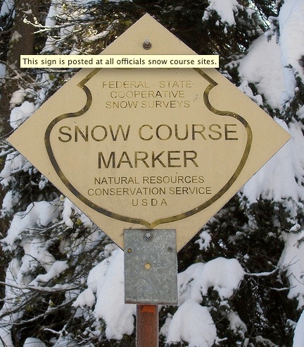
By the way: snow courses are usually located in remote backcountry locations where snowfall accumulates. Because the work can be dangerous, the technicians, hydrologists, engineers and volunteers that serve as snow surveyors attend training every three to five years to maintain their survival skills. At “Snow School” they learn snow sampling, avalanche recognition, outdoor survival and backcountry emergency care. They even build snow shelters and spend the night in them!
To measure the snow we use an official Federal Snow Sampling tube which is an eight-foot long hollow tube precisely 1.485 inches in diameter. That’s so 1 ounce of tube weight exactly equals 1 inch of snow water equivalent.
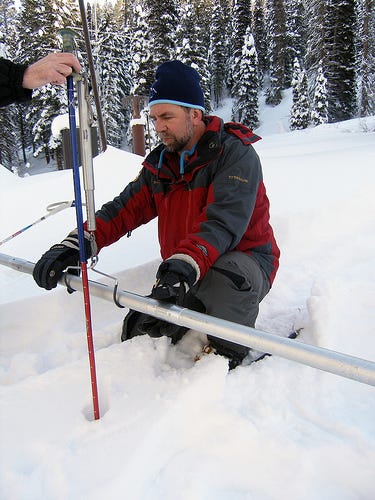
The tube is plunged straight down through the snow to the ground to get the sample. First we measure the snow depth using the ruler on the tube.
Then we carefully extract the tube with a snow core and weigh it – tube, snow and all.
Subtracting the empty tube weight from the tube and snow weight reveals how much water is in the snow. This data is used to accurately forecast spring runoff and predict summer water supplies. Good job – you’ve now measured the snowpack!
Besides these manually measured snow courses, NRCS maintains 800 automated sites (called SNOTEL for SNOw TELemetry) that collect snow, precipitation and temperature data available on NRCS Web pages. The data are used by hydrologists, planners, engineers and others to manage water supplies for industry, cities, recreation and wildlife.
For over 100 years, snowpack data has been collected to forecast agricultural water supplies in the West – thanks for helping carry on the tradition!
You May Also Like
Enter a zip code to see the weather conditions for a different location.


