Subscribe to receive top agriculture news
Be informed daily with these free e-newsletters

New Mexico dams are agingDams beyond anticipated life spanDams now protecting resources outside original design parameters
October 17, 2016
Dams constructed in the 1960s to protect New Mexico farmland from flooding have exceeded their life expectancy—and at a time when their responsibility extends to urban and residential areas which were not part of the original design.
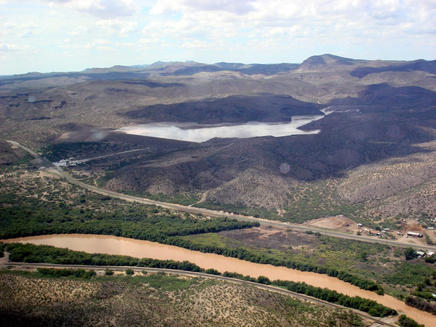
A 2400 square mile watershed area encompasses an area from the Black Range northwest of Caballo Dam, south to the New Mexico/Texas state line. For about 800 square miles of that area, or about one-third of the watershed, no infrastructure exists to manage storm water, according to sources with the South Central New Mexico Stormwater Management Coalition (SCNMSMC). The coalition is comprises of nine different reginal entities.
Lack of infrastructure to manage storm water results in severe erosion, flooding, and large quantities of sediment and debris being dumped on residences, farm fields, highways, and streets during severe weather.
The coalition needs funding to maintain existing dams.
Zack Libbin, Elephant Butte Irrigation District (EBID) engineer and chairman of the SCNMSMC, says “Unfortunately it is human nature to say, ‘Oh, that dam’s been there forever,’ and people either forget about the dams or take for granted that someone else is maintaining them.”
Each Coalition entity prioritizes their own dam maintenance and then works to locate funding for contractors or EBID to do the needed work. “Currently there is very little funding available to implement the dam upgrades needed to protect residential areas,” according to the Coalition. “Storm water management is typically planned, funded, and implemented independently by a variety of public agencies in towns, cities, and districts spread throughout the region.”
Those agencies have been successful in obtaining limited capital outlay money for a few improvements. However, they make the point that “stormwater does not respect political boundaries.”
EBID owns five dams: Picacho North, Picacho South, Lucero, Dona Ana North, and Tortugas #1, and co-sponsors 21 more, along with the Caballo Soil and Water Conservation District, Dona Ana Soil and Water Conservation District, and the Dona Ana County Flood Commission.
The district provides labor for much of the maintenance for the Dona Ana County Flood Commission, which requests maintenance via an MOU (Memo of Understanding) for needed work like sediment removal and removal of woody growth on the dam. Although most of these dams were designed for sediment capture, increased levels of sediment reduces the storage volume for water of a dam, increasing risk for downstream residents.
Many of the dams have reached their design life span and maintenance is needed to extend their life. Recent rehabilitation of Garfield Dam models the type of ongoing maintenance work critically needed on all dams in the area.
Development of a sensor system to improve flood control dam safety and aid in stormwater capture and dispersal from these structures has been an EBID priority. EBID is in the process of installing remote terminal units (RTUs) on EBID maintained dams to collect water level data, providing information for water management decisions on outflow from the dam’s spillways.
These sensors will provide a critically needed public safety component. Each site will have two to three alarm levels designed to alert personnel when water initially shows up, overflows the release structure, and is approaching the emergency spillway level. By monitoring accumulating storm water EBID will be able to provide early warning for potential hazards and anticipate incoming river channel flows for downstream diversion and capture. Due to state law, most flood control dams can only detain water for 96 hours; however, this is sufficient time to reduce storm flow, thereby potentially reducing the quantity needed for release from Caballo Dam if well planned.
For the latest on southwest agriculture, please check out Southwest Farm Press Daily and receive the latest news right to your inbox.
All "jurisdictional" dams have strict standards put in place by the Office of the State Engineer Dam Safety Bureau regulations. EBID’s Engineering and Maintenance Departments constantly work towards achieving compliance requirements of the State Engineer for the dams EBID is responsible for. District Engineer Libbin and GIS Analyst Dennis McCarville utilize GIS and other technology to develop required dam flood inundation maps of affected areas should a dam give way or breach. These dam breach analyses are required as part of Emergency Action Plans in the event of dam failure or other emergency.
It is critical that sponsors put forth the money and effort necessary to maintain the dam structures but additional funding is needed, say Coalition sources. After fifty plus years of protecting primarily farmland, today dams also protect communities, greatly complicating the safety factor. Through its extensive system of RTUs monitoring precipitation data all the way down the system to the alarms and alerts set up on the flood control dams, EBID is actively working with others not only to reduce the risk associated with flooding but also to utilize the abundant but fleeting resource of a good storm.
You May Also Like
Enter a zip code to see the weather conditions for a different location.


