July 12, 2016

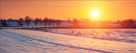
LA NIÑA SIGNALS: The strongest signal from a La Niña comes during the winter months, where temperatures are generally cooler than normal in the northern part of the U.S. Historical events have usually received near- or below-normal precipitation from November to April in Nebraska.
The definition of weather is the state of the atmosphere at a place and time. Climate is defined as the prevailing weather conditions in an area over a long period. No matter how you look at it, climate is what you expect and weather is what you get. We know all too well in Nebraska, expectation and realization can be polar opposites. Weather comes up in almost every conversation because of this high variability, but also because of the impact weather has on our agricultural industry. We know the best fertilizer management in corn or a perfectly designed ration at a feedlot can have an impact on production, but nothing can overmatch the impact weather can have on your operation. This is nothing new or surprising to any Nebraskan, but it is the reason why we focus so much on weather and climate predictions.
Why does La Niña matter?
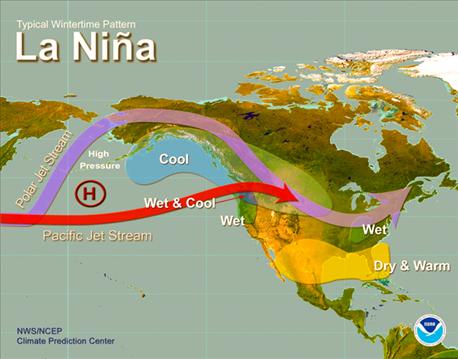
LA NIÑA IS LIKELY: There is high confidence a La Niña will be in place this winter. Thus, the probabilities increase of seeing La Niña-like conditions in the winter outlook, as illustrated in this map from the Climate Prediction Center.
As you have heard, La Niña is on the way. After about a year with El Niño, that weather pattern has finally dissipated, and we have quickly transitioned to cooler-than-normal sea surface temperatures in the equatorial region of the eastern Pacific Ocean. This transition has been predicted for a while and is common to past El Niño/La Niña episodes. These past events allow us to analyze the impacts La Niña “typically” has on our region, and use those events to aid in creating seasonal forecasts. Everyone wants to know what the next season holds, but long-term forecasts in the central part of the U.S. are sort of like throwing darts blindfolded. However, analyzing the historical La Niña events in combination with current weather models allow us to throw darts with part of one eye open. It may not get us a bull's-eye, but our odds are a lot better.
The challenges with using this La Niña for our late-summer forecast are the late arrival of La Niña and the lack of consistent historical impacts during the summer. Previous La Niña episodes tend to be warmer and slightly drier than normal in July, August and September for most of the Midwest and Corn Belt. However, the late transition from El Niño may minimize the impact from the upcoming La Niña. The strongest signal from a La Niña comes during the wintertime, where the winter months are generally cooler than normal in the northern tier of the U.S. The precipitation pattern is not as consistent, but historical episodes have generally had near- or below-normal precipitation from November to April in Nebraska.
What actually is normal?
The long-term forecasts are typically produced in terms of the probability of conditions being above- or below-normal. Climate normals are the three-decade averages of temperature and precipitation, with the most recent period being 1981 to 2010.These are calculated every 10 years, so they can fluctuate with climate trends. These are not historical averages that would take into account the weather conditions of the past 100 to 120-plus years.
Long-term outlook
The latest forecast for August through October from the Climate Prediction Center (CPC) gives our region an increased probability of being warmer than normal. This forecast has remained fairly consistent for the last few months. The precipitation forecast has been consistently neutral and has not been providing much confidence in receiving above- or below-normal precipitation. This is not uncommon for this time of year, especially with a long-term forecast. Most of our precipitation the next couple months will come in convective systems, and this can severely limit the predictability, especially since ENSO (El Niño Southern Oscillation) is not providing a strong signal.
The forecast moving into the winter starts to mimic La Niña conditions. The CPC keeps the increased odds for above-normal temperatures through the fall, but the odds start to decrease as we get into the early winter period. The CPC starts to introduce increased odds for below-normal temperatures for some of the northern states during the midwinter time frame. There is high (about 70%) confidence a La Niña will be in place this winter — thus the increased probabilities of seeing La Niña-like conditions (see map above) in the winter outlook. This may change with the strength of La Niña and the subsequent atmospheric response, so it will be important to watch for upcoming ENSO updates.
Williams is a University of Nebraska Extension educator in Lancaster County.
You May Also Like

