Could big floods and lots of damage happen in Indiana? History indicates such disasters are not limited to lower-lying areas like Louisiana. A major flood could happen here — and in fact, it already has. Part of the town of English in Crawford County, built in a flood-prone area, has flooded several times. A good portion of Franklin, built in a low-lying area, was wiped out in the fluke rainstorm of June 2008. Some 50 houses were never rebuilt. A park occupies that spot today.

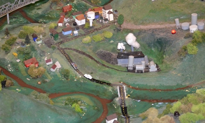
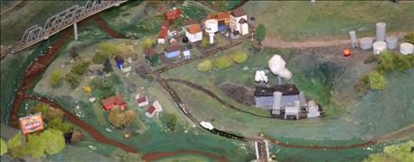
VALUE OF PLANNING: The Indiana Department of Natural Resources uses this model to show the value of planning for a flood disaster. You hope your family settled in Dryville, not Wetville, when the big thunderstorm happens.
The Indiana Department of Natural Resources constructed a detailed model that illustrates what happens when a large rain event occurs in both rural and urban areas. Displayed at the Indiana State Fair this year, it’s accompanied by a computer-programmed audio description that explains minute by minute what is happening as a huge rain event descends on this "anywhere Indiana" landscape. As the rain increases, water flows, low-lying areas flood and even levees for reservoirs are threatened. The value of planning and periodic maintenance is illustrated in almost too-real ways.
Here is a step-by-step description of a mock storm and resulting flood in the IDNR model.
Step 1. A thunderstorm begins in the morning. Soon water is collecting in the streets of Wetville, a town built on lower ground. Proper planning years ago might have indicated the town could have been better located on higher ground.
Step 2. The thunderstorm intensifies during the late-morning hours. Cars and trucks parked along the streets are swept away in Wetville. Water levels begin rising in creeks running through the rural landscape. The model's realistic landscape includes hills, forests and cropland.
Buildings and vehicles in the town of Dryville, located on higher ground, aren’t yet threatened. The town is built on an upland area away from low-lying waterways where flooding is more likely.
Step 3. The National Weather Service extends flash-flood warnings for Wetville. NWS also issues flash-flood warnings for the area surrounding Dryville. Small lights on the display turn on as the flood warning is expanded, showing that areas built in proper locations and designed to withstand flooding can be threatened if a storm becomes a once-in-a-100-year event.
A reservoir located above the town of Dryville protects it, as well. Reservoirs are often planned and constructed as a means of flood control to help protect areas in the event of major storm events, IDNR representatives note. Some are also used for drinking water supplies for various municipalities.
Step 4. Engineers become concerned about the integrity of the levee holding water in the reservoir. Water continues flowing, flooding and filling the reservoir on the model as the storm event continues. Engineers trained to understand how levees work and when they might be threatened become concerned. Many levees are old and may have weak spots. Regular maintenance is needed to keep levees in good condition.
Step 5. The rain subsides. Just in the nick of time, the storm lightens up. The levee holds. But the lesson is clear. Planning for natural disasters pays, and events like floods create dangerous situations, especially in low-lying areas.
About the Author(s)
You May Also Like


