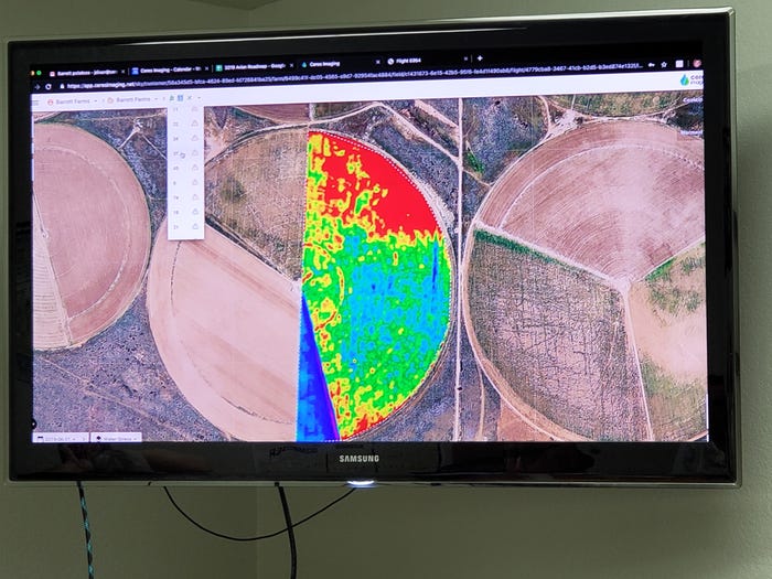
High-resolution multispectral imagery by Ceres Imaging.Shelley E. Huguley
Potato farmer Steve Barrett, Springlake Potatoes, Springlake, Texas, describes the multispectral images by Ceres Imaging as another tool in the decision toolbox.
Steve and his brother Bruce Barrett, who produce red and yellow potatoes in the sandy soils of Lamb and Bailey counties, are hoping the real-time imagery generated by Ceres will expose insect and disease issues before they have a chance to hurt potato yield or quality.
While the Barrett brothers don't expect the aerial imagery to replace in-person inspections, they're hoping the layered pictures will reveal what they can't see. “The images are confirmation of what we’re doing or if we are missing something, even though we are driving by the fields all the time. We’re not trying to eliminate going out and looking; we’re still going to do that," Steve says.
“I think with most technologies you don’t know how you are going to use them for a while. We might end up using this in a way we don’t anticipate.”
See, Potato farmers use real-time imagery to increase production efficiency
About the Author(s)
You May Also Like


