Silage harvest is mostly complete and seed corn harvest is in full swing in Iowa. A few farmers have started harvesting corn and soybeans and with the drier weather continuing, we'll see more combines in fields in the next few weeks.
That's the conclusion of the weekly weather and crop conditions survey, released September 12 by the Iowa office of USDA's National Ag Statistics Service (NASS) in Des Moines. The weekly report is available on the Iowa Department of Agriculture & Land Stewardship's website www.IowaAgriculture.gov or on USDA's site www.nass.usda.gov/ia. Here are highlights of the latest report:
Iowa Crop Conditions as of Sept. 11, 2011
This Week Last Week
Fair Good Excellent Excellent
Corn 28% 45% 12% 11%
Soybeans 24% 48% 16% 14%
Average temperature for the week ending September 11 varied from morning lows of 37 degrees F at Sheldon in northwest Iowa on Monday (September 5), to a Sunday (September 11) afternoon high of 89 degrees F at Mason City. Temperatures for the week as a whole averaged near normal over far northwest Iowa to 4 to 5 degrees below normal over southeast Iowa, and the statewide average was 2.0 degrees below normal. Precipitation was only a trace for the entire week statewide, while normal for the week is .85 inches.
Corn moisture still high for grain harvest, farmers are getting ready
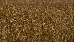
Most of Iowa remained dry for the past week as farmers made progress harvesting corn for silage. Seed corn harvest is also well underway. Corn moisture levels remain too high for widespread "corn for grain" harvest although many farmers are making preparations to get ready to start combining corn.
There were 6.5 days suitable for fieldwork statewide during the week which ended September 11. This is the highest statewide "days suitable for fieldwork" thus far in the 2011 crop year. Topsoil moisture fell to 12% very short, 33% short, 53% adequate and 2% surplus. Subsoil moisture also declined slightly to 11% very short, 34% short, 54% adequate and 1% surplus.
Iowa corn condition has improved, is now 57% "good to excellent"
Nearly all of Iowa's 2011 corn crop has advanced to at least the dough stage now. And 93% of the corn is at or beyond the dent stage, behind last year but 10 percentage points ahead of normal. One-third of the Iowa 2011 corn crop is now mature, behind last year's 56% but slightly ahead of the normal 30%. Corn condition improved last week and now stands at 5% very poor, 10% poor, 28% fair, 45% good and 12% excellent.
Nearly half of Iowa's soybean fields are turning color as of September 11, trailing last year's 70% and the 5-year average of 63%. Just 8% of Iowa's soybean fields are dropping leaves, one week behind last year and one week behind normal. Like corn, the condition of Iowa's 2011 soybean crop has also improved during the past week and is now rated at 4% very poor, 8% poor, 24% fair, 48% good and 16% excellent. Third cutting hay harvest is 90% complete statewide, equal to last year at this time but ahead of the normal 83%.
With short crop, will hay supply be adequate for upcoming winter?
The 2011 hay crop is reduced not only in Iowa but elsewhere in the country too. There are concerns about adequate hay supply for the upcoming winter in Iowa. The condition of Iowa's 2011 hay crop, as of September 11, is reported at 7% very poor, 17% poor, 32% fair, 37% good and 7% excellent.
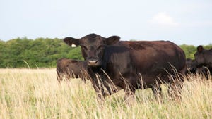
Pasture conditions are currently rated 11% very poor, 22% poor, 32% fair, 30% good and 5% excellent. Livestock conditions have been ideal this past week.
IOWA PRELIMINARY WEATHER SUMMARY—as of Sept. 11, 2011
By Harry Hillaker, state climatologist, Iowa Department of Agriculture & Land Stewardship
For the week ending September 11, 2011 Iowa recorded its driest week in 30 weeks (the driest week since early February) with measurable precipitation restricted to extreme southeast Iowa on Friday night. Salem (a town in Henry County in southeast Iowa) and Keokuk in Iowa's southeast corner reported the most rain with 0.26 inch this past week. The statewide average precipitation was only a trace while normal for the week is 0.85 inch.
The reporting week began with unseasonably cool weather with highs only in the 60s in many areas of Iowa on Monday, Tuesday and Wednesday (September 5, 6 & 7) despite sunny skies. A slow warming trend began on Thursday and continued through the weekend. Temperatures varied from morning lows of 37 degrees F at Sheldon on Monday September 5 and Mason City on Tuesday September 6 to a Sunday (September 11) afternoon high of 89 at Mason City.
Temperatures for the week as a whole averaged near normal over the far northwest to 4 to 5 degrees below normal over the southeast region of Iowa with a statewide average of 2.0 degrees F below normal.
About the Author(s)
You May Also Like


