
Subscribe to receive top agriculture news
Be informed daily with these free e-newsletters
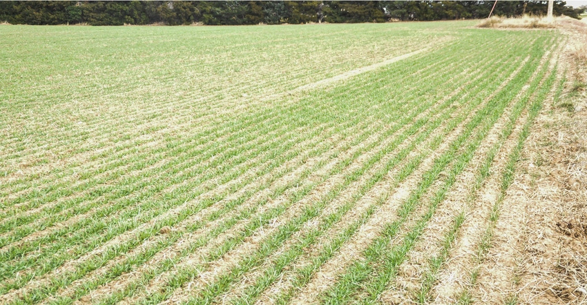
Just about the time that Kansas farmers were getting used to a later-than-normal freeze date as the “new normal,” Mother Nature decided to revert to “pretty close to normal” this year and bring a hard freeze to most of the state on Oct. 27.
The freeze hit before much of the winter wheat crop — which was planted later than normal because of dry conditions in late September and early October, and because growers were worried about avoiding this year’s issues with wheat streak mosaic — had gotten up and growing.
The freeze also hit before some of the double-crop grain sorghum and soybeans were fully ready for harvest. Many soybean fields, in fact, had just turned color and hadn’t even started dropping leaves when the freeze hit.
Cotton producers were pretty much ready for harvest, and most had already sprayed boll opener before the freeze. For some producers, the timing of the freeze was ideal to spare them the expense of a paraquat application to fully desiccate the crop in time for harvest.
Farmers who had hoped to get fall or winter forage crops up and growing to turn cattle out for winter grazing will likely find the progress of that pasture hampered somewhat by the hard freeze, although a return to milder conditions during the months of November and December could still encourage sufficient growth on winter forage.
Moving forward, forecasters are still predicting a relatively dry and mild winter for Kansas, with a weak La Niña expected in the equatorial Pacific as winter progresses.
The long-range forecast from the National Climate Prediction Center has Kansas at a 33% chance of above-average temperatures, and at an equal chance for above- or below-normal precipitation for the months of December, January and February.
A La Niña is the result of cooler-than-normal ocean water temperatures in the equatorial Pacific. The cooling of the ocean impacts the wind currents that steer storms across North America, resulting in a more northerly storm track for winter storms and less precipitation across the Southern Plains.
The forecasting service, Accuweather, is predicting an overall milder-than-normal winter for most of Kansas, with a good chance that a few plumes of Arctic air will blast into the state and bring short periods of very cold weather.
Fortunately for most of Kansas, recent widespread rains have left almost all of the state in good shape for subsoil moisture going into winter, and the freeze will halt vegetative growth and use of water.
You May Also Like
Enter a zip code to see the weather conditions for a different location.


