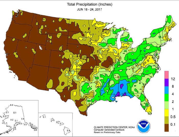
Minimal Tropical Storm Cindy made landfall near the Texas-Louisiana border before daybreak on June 22, contributing to a storm surge along the Gulf Coast; flooding rains (locally a foot or more) in the central Gulf Coast region; and heavy showers and locally severe thunderstorms in parts of the Southeast and from the Mississippi Delta into the Ohio Valley. Cindy’s remnant circulation was ultimately absorbed by a strong cold front crossing the Mid-Atlantic region. Prior to interacting with the former tropical storm, the cold front sparked showers and thunderstorms in the
Midwest. In addition, cool air trailed that front, as well as a previous one, helping to hold weekly temperatures as much as 5°F below normal across the northern Plains and upper Midwest.
However, rain again mostly bypassed the driest areas of eastern Montana and the western Dakotas, maintaining stress on rangeland, pastures, winter wheat, and summer crops, despite the
lower temperatures.
About the Author(s)
You May Also Like


