

Subscribe to receive top agriculture news
Be informed daily with these free e-newsletters

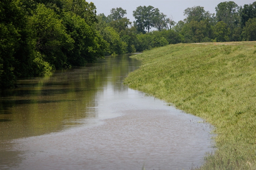
Sand boils can be nuisance areas of fields where farmers can lose equipment or production, or they can be an indication of problems with a levee.As they fight the unprecedented water levels in the Mississippi River, Corps of Engineer and Levee Board personnel are treating all sand boils seriously.Depending on the material in the water and their proximity, sand boils can be an early warning of potential problems with the levee system.
May 11, 2011
Army Corps of Engineers officials continue to maintain the mainline levee will hold back the rising floodwaters from the Mississippi River. Nevertheless, they are keeping a close watch for sand boils on both sides of the river.
Sand boils are areas where water under pressure from the near-record levels in the Mississippi can move under the levee and begin to percolate up through the soils on the land side of the mainline levee and tributary levees.
Whether a sand boil poses a threat to the mainline levee or backwater levees depends on the composition of material in the water bubbling up out of the sand boil and how far the sand boil is from the levee, says Col. Jeff Eckstein, commander of the Army Corps of Engineers’ Vicksburg District.
“Sand boils are not a big problem as long as it’s just water moving from one location to another,” Eckstein said. “When you start having concerns about sand boils is when the water coming up through the sand boil has a lot of material in it, and you don’t know where that materials coming from.”
Eckstein briefed several hundred Delta residents during the annual meeting of the Stoneville, Miss.-based Delta Council in Cleveland, Miss., last Friday (May 6). Recent inspections indicate the mainline levee is sound, he said, but the Corps will continue to keep watch for sand boils along the length of the Mississippi River flood control system.
“Standard flood fighting techniques are that you take sand bags and put pressure on the ground around the sand boil. That will keep material from moving with the water. You raise it up a little bit. When you raise the elevation around the sand boil you don’t have water wanting to travel as much.”
That is basically what happened when the Mississippi Levee Board and the Corps asked for assistance in fighting a sand boil on the Mississippi side of the levee near Gunnison in Bolivar County Monday night and early Tuesday morning (May 9-10).
Responding to the call, Bolivar County Sheriff Mack Grimmett took 22 inmates from the Bolivar County Jail and a handful of deputies to the site of the boil and began stacking sand bags around the boil, which was located just off Highway 1 north of the community of Deeson.
Earlier on Monday, Levee Board personnel had sandbagged one boil in the area which was the location of several sand boils during a high water event in 2008. When a second boil formed Monday night, the Levee Board asked for assistance from the Bolivar County sheriff.
The Levee Board’s Peter Nimrod said the sand boil at Deeson was a cause for concern because it contained brown material, which may have come from the mainline levee. An inspection of the levee indicated no damage to the structure.
During high-water situations, sand boils can occur a mile or more from the main levee, according to Eckstein. In this case, farther away is better.
“We get concerned when we have sand boils that are pretty close to the toe of the levee,” he said. “If it’s close to the levee, most likely you’re having an impact on the levee. So we want the sand boils to be as far away from the levee as possible. Close is not as good.”
Eckstein said a levee certification program that was begun last year indicates the Corps will have three feet of freeboard between the water line from the Mississippi when it crests and the top of the mainline levee.
Levees for the Yazoo River Backwater System will be overtopped when the Mississippi reaches 56.2 feet on the Vicksburg gauge. “That’s the way the system is designed, and there will be flooding in the Yazoo Backwater area,” he noted. How much depends on additional rainfall and the structural integrity of the backwater levees.
“If we had a levee failure, we could have more than 1.2 million acres of cropland under water and many more residences and businesses flooded,” he said. “We do not believe that will happen, but we are making preparations in the event it should happen.”
In preparation, Corps personnel have been raising the levees where inspections have indicated they are not at full height. (The backwater levee has been found to be one to 11 inches lower than it should be in a few places.) They are also placing plastic coverings over the tops of the levees to try to minimize erosion of the levee surfaces when water begins flowing over the levees.
You May Also Like
Enter a zip code to see the weather conditions for a different location.


