Subscribe to receive top agriculture news
Be informed daily with these free e-newsletters

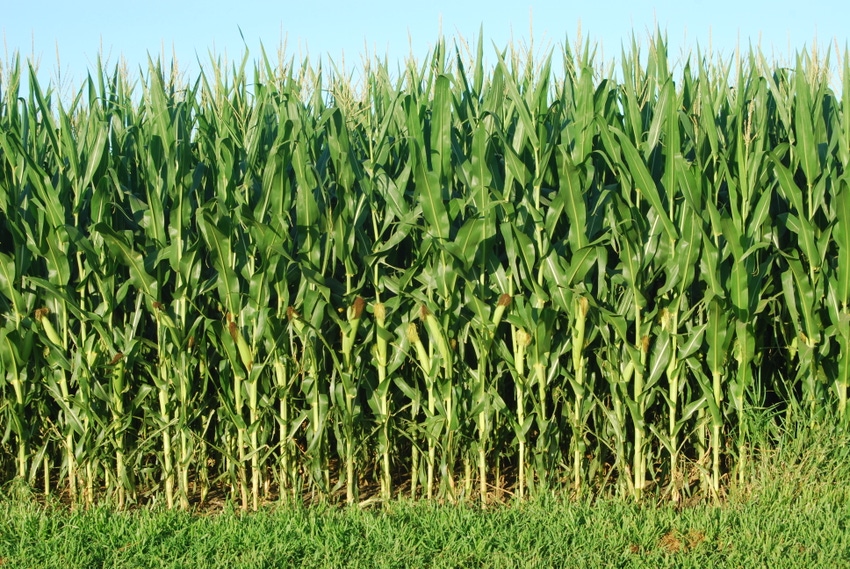
Corn crop as of July 29 was 96% silked, two weeks ahead of schedule.
August 1, 2018
In Iowa this week, the big news with crops and weather is how fast the corn and soybean crops are progressing. USDA’s weekly survey released July 30 showed 96% of the state’s corn crop was silked, 10 days ahead of last year and two weeks ahead of the five-year average. For soybeans, 63% of the crop was setting pods, six days ahead of last year and eight days ahead of average.
South-central and southeast Iowa, however, continue to miss the rain and thus continue to stay dry. “Unfortunately, southern Iowa remains very dry with more than 70% of south-central and southeast Iowa rated short or very short of subsoil moisture,” notes Mike Naig, Iowa ag secretary. “Crop development remains well ahead of the five-year average statewide, however. It has also been good weather so far, for farmers making hay. The USDA survey shows as of July 29, that 13% of the third cutting of alfalfa is now complete.”
In southwest Iowa, “corn and soybean crops look pretty good overall,” says Kevin Ross, farming near Minden. “There is a lot of wind damage in corn fields this year in certain areas. High wind and greensnap damage occurred around first of July. Now we are looking at those fields a month later, moving into August, and we can see the wind damaged areas.”
Overall, for a lot of farmers, “this is probably not going to be as good of a corn and soybean crop in southwest Iowa as was harvested here last year,” Ross says. “But for other farmers, it’s going to be exceptional again, pushing for the top yield goal.”
Effects of windstorm, a year later
“In our fields here on our farm at Minden in Pottawattamie County, we ended up with anywhere from a couple percent of the plants snapped off, all the way up to 25% in a couple of spots, depending on the corn hybrid,” Ross says. “Some hybrids are more susceptible to greensnap than others. Also, the amount of damage depends on how the wind hit on the hillside, so there are some spots you see that are worse than others. If you haven’t been out to check those fields, I’d encourage you to do so — to peel back some ears and inspect the kernels and see what is there.”
The weekly Iowa Crop Progress & Weather Report is available on the Iowa Department of Ag and Land Stewardship at iowaagriculture.gov or on USDA’s site at nass.usda.gov/ia.
Crop report
Iowa farmers had 6.3 days suitable for fieldwork during the week ending July 29, according to USDA’s National Ag Statistics Service. Activities for the week included harvesting hay and oats for grain, applying chemicals and moving grain.
Topsoil moisture levels rated 5% very short, 20% short, 71% adequate and 4% surplus as a statewide average. Subsoil moisture levels rated 6% very short, 17% short, 72% adequate and 5% surplus. Floodwaters continued to recede in northwest and north-central Iowa, while subsoil moisture levels that are rated short to very short remain in about 70% of south-central and southeast Iowa.
Iowa’s corn crop as of July 29 was 96% silked, 10 days ahead of last year and two weeks ahead of the five-year average. And 31% of the corn crop had reached the dough stage or beyond, five days ahead of last year and six days ahead of average. Corn condition rated 78% good-to-excellent.
Iowa soybean crop 77% good-to-excellent
Looking at Iowa’s soybean crop, 90% was blooming with 63% setting pods, six days ahead of last year and eight days ahead of average. Soybean condition rated 77% good-to-excellent. And 97% of the oat crop was turning color or beyond, with 61% of the crop harvested for grain. Oat condition was rated 75% good-to-excellent.
Second cutting of alfalfa hay reached 93% complete for Iowa, 11 days ahead of average. The third cutting of alfalfa hay was 13% complete, one day ahead of average. Hay condition rated 68% good-to-excellent. Pasture conditions declined a little, to 54% rated good-to-excellent. Cooler temperatures improved livestock conditions; however, drought conditions in the southern one-third of Iowa caused some cattle producers to rotate pasture and haul water.
Weather summary
According to Justin Glisan, IDALS climatologist, the last full week of July greeted Iowa with unseasonably cool temperatures and relatively dry conditions. Daytime highs over most of the state were in the lower 80s, 2 to 3 degrees below normal, for the week ending July 29. Overnight lows were cooler as well, dipping into the upper 50s, 4 to 6 degrees below normal. Statewide precipitation totals were between 0.25 to 1.2 inches below normal; only parts of Mills and Fremont counties observed slightly above-average precipitation.
A cold front moved through Iowa early on June 23, bringing measurable rainfall to the state’s western third to start the week. Little Sioux (a town in Harrison County) reported 0.52 inch of rain, while other locations in Sioux and Lyon counties observed between 0.25 and 0.33 inch. June 24 was a quiet day statewide, with Bellevue (Jackson County) reporting the week’s high of 97 degrees.
Severe thunderstorms, straight-line winds
Active weather returned on June 25, as another cold front moved through, firing up severe thunderstorms in north central Iowa. There were more than 10 reports of severe straight-line winds and pea to quarter-sized hail; Dows (Wright County) reported large broken tree limbs of up to 8 inches. The line weakened and propagated through the eastern third of the state. Mason City (Cerro Gordo County) reported 0.80 inch of rain, while Waterloo (Black Hawk County) had 0.16 inch.
High pressure dominated June 26-27, bringing fair and cool conditions. June 28 was a wet day for western and southern Iowa, as a system brought measurable rainfall. Rathbun Dam (Appanoose County) recorded 0.98 inch of rain, the week’s highest accumulation; 16 weather stations in Iowa had accumulations of at least one-half inch. Thundershowers lingered into the morning of June 29, with isolated storms popping up in the afternoon. Weekend average highs were well below normal, especially in the southwest. Mount Ayr (Ringgold County) recorded a high of 66 degrees, 19 degrees below normal.
You May Also Like
Enter a zip code to see the weather conditions for a different location.


