Subscribe to receive top agriculture news
Be informed daily with these free e-newsletters

State climate office to produce usable products with information it collects through the statewide weather network.
August 5, 2016
The newly formed Nebraska State Climate Office has set a goal of producing usable products with the information it collects through the Nebraska Mesonet, its statewide weather network.
The state climate office conducted a four-week survey of agriculture industry representatives through Nebraska Extension's CropWatch.

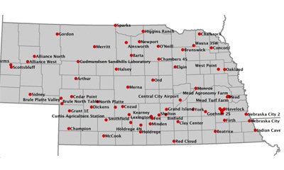
REAL-TIME REPORTING: The Nebraska State Climate Office is updating Mesonet weather stations across the state this summer to provide more real-time reporting to the web.
"NSCO wanted to assess what agriculturally specific information people are using in Nebraska, and for what specific decisions," says Martha Shulski, director of the Nebraska State Climate Office and state climatologist. "Our purpose was also to establish a baseline needs assessment so we can track how needs change and evolve over time with future surveys. With this information, we will prioritize our product development to focus on the most utilized variables and in the preferred format."
Based on the feedback collected, the climate office will focus on the visualization of the Nebraska Mesonet data first for its suite of website tools.
"Users will be able to view temperature, precipitation and many other observations in near-real time to help in their farming decisions," Shulski says. "We will also be displaying calculated variables such as growing degree days and evapotranspiration — two very important metrics for producers."
As the office runs maintenance checks on its weather stations this summer, it is updating each station's communications capability so data can be reported hourly to the Mesonet weather reporting sites in Nebraska. The updates will provide more real-time reporting online.
The Nebraska State Climate Office website is due to go live in late summer or early fall, with additional tools for users being added as they are created.
Sixty-seven percent of survey respondents regularly sought out websites, such as the National Weather Service, CropWatch and the High Plains Regional Climate Center, to access the data they want to use to make educated decisions. About 61% turned to local television stations for information, and 71% turned to smartphone apps.
The site also will present data in map and table form, the two most common requests from respondents for making data easy to read and comprehend — 75% of respondents wanted to see data displayed on maps.
As for what Mesonet-collected data they use, 100% of respondents said they use precipitation, air temperature and soil temperature data, and 84% used short-term forecasting. More than half also used the eight- to 14-day forecast, soil moisture, evapotranspiration, growing degree days, humidity, soil temperature, seasonal forecast and wind speed data. Less popular were air pressure, frost depth and modeled weather products.
Future improvements to the Mesonet system include making hourly updates available. The data are expected to make it easier for farmers to make crop decisions ranging from the best time to start planting and to water, to when to apply fertilizer or start harvest.
Source: University of Nebraska-Lincoln News
You May Also Like
Enter a zip code to see the weather conditions for a different location.