June 29, 2010

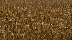
For generations, the standard measure for corn growth was “knee-high by 4th of July,” which meant that the corn plant should be able to produce a crop for that year. Of course, most farmers a couple of generations ago had much lower yield goals for their corn than the farmers of today.
Today, waist-high – or higher –corn by July 4 is more typical, and has resulted in some very good corn yields in most areas in recent years. It would be difficult to get exceptional corn yields in southern Minnesota if corn was only knee-high or shorter on July 4.
The 2010 crop year in Minnesota and northern Iowa started out very good, with an early planting season; however, the 2010 corn crop was set back by a Mother’s Day hard frost on May 9. In recent weeks, adequate rainfall in most areas, along with warmer-than-normal temperatures, have provided very favorable growing conditions most of June. This has allowed most corn in southern Minnesota and northern Iowa to be more than waist-high by July 4, with some early planted corn approaching shoulder-high. Of course, the exception to this are areas that have been impacted by the numerous severe storms during the last half of June that has caused considerable damage to many cornfields across the region.
Corn and soybean development has extended at a rapid pace during the last two weeks in June, as a result of above-normal temperatures and accumulation of growing degree units(GDUs) during that period. At the University of Minnesota Southern Research and Outreach Center at Waseca, MN, a total of 847 GDUs had been accumulated from May 1 through June 28, 2010, which is slightly ahead of normal GDU accumulation for late June. However, much of the corn in southern Minnesota was planted from April 10-25, and thus benefitted from some significant GDU accumulation prior to May 1. The GDU accumulation from May 1 to late June is running near normal to slightly above normal in most areas, following some significant increases in GDU accumulation in the last half of June.
June rainfalls have been quite variable across the region, with most areas of southern Minnesota and northern Iowa receiving adequate to excessive amounts of rainfall during June. Total June rainfall at Waseca totaled 9.64 in. as of June 28, compared to a normal June rainfall of 4.22 in. The total precipitation for 2010 through June at Waseca is now at 17.92 in., compared to a normal of 16.24 in.
Some portions of the region have received frequent excessive rainfall amounts during the last three weeks of June, and even more rainfall than was recorded at Waseca during June. This has led to problems for applications of post-emergence herbicides for weed control, and has caused some leaching of available nitrogen in the soil profile. The very wet conditions have also lead to problems with harvesting quality alfalfa, and for the beginning of the canning pea harvest. There have been widespread reports of excessive rainfall, wind, and hail damage during severe storms in mid-late June, which has caused considerable crop damage in some areas.
Severe Storms Hit Minnesota
For the second week in a row severe storms ravaged large portions of southern and central Minnesota, with tornadoes, strong winds, lightning, hail and heavy rains. Damage was severe and wide spread, but fortunately no deaths and only a few injuries.
These storms caused considerable property damage to homes in towns, rural communities and farm sites across the region, as well as damage to livestock facilities, grain bins, machinery storage facilities and other farm buildings. In addition, many farm operators have incurred significant crop damage from wind, hail and excessive rainfall. No estimates have been released as far as total acres impacted by the crop damage, but it is likely to amount to tens of thousands of acres. The once optimistic outlook for 2010 crop yields has now diminished somewhat for growers in many locations in Minnesota.
Editor’s note: Kent Thiesse is a former University of Minnesota Extension educator and now is Vice President of MinnStar Bank, Lake Crystal, MN. You can contact him at 507-726-2137 or via e-mail at [email protected].
About the Author(s)
You May Also Like


