La Niña is back and is likely to have an impact on weather around the world, but especially affecting winter weather across the United States.
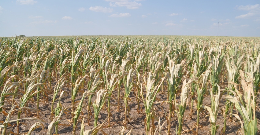
For Kansas, La Niña winters are generally warm and dry, which is cause for concern given that about a third of the state, especially in the southwest and southeast, are already abnormally dry.
It’s also bad news for southern California where an already devastating wildfire season is likely to last longer than normal.
Forecasters said the models also predict that La Niña conditions will continue through the Northern Hemisphere winter of 2020-21 and the consensus favors a borderline moderate event during the peak November to January period.
The strength and duration of the event is also important, because the stronger La Niña is and the longer it lasts the greater the impact on weather in the U.S. and around the world.
Below-average sea surface temperatures were extending across the central and eastern equatorial Pacific Ocean according to monitoring by the Center for Climate Prediction’s El Niño/Southern Oscillation diagnostic discussion released on Sept. 10.
All El Niño indices were negative and atmospheric circulation anomalies over the tropical Pacific were also generally consistent with La Niña, the discussion reported, with low-level and upper-level winds near average for the month as a while, but enhanced low-level easterly winds were prominent across the equatorial Pacific Ocean during August.
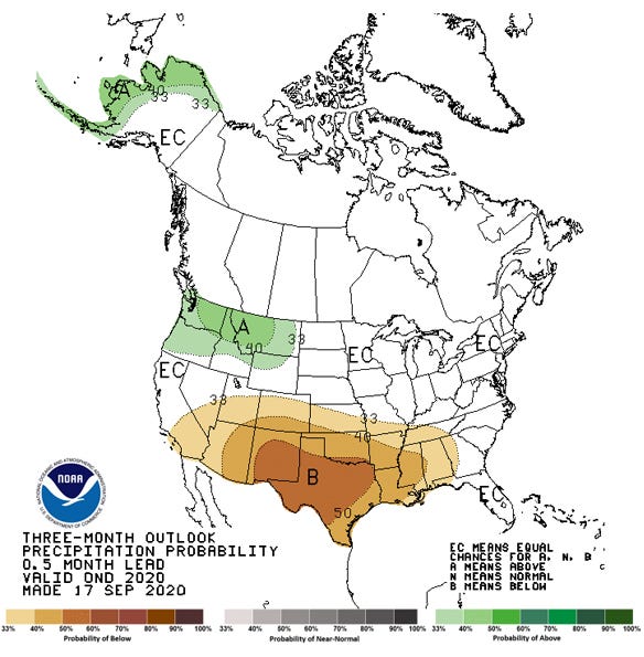
PRECIPITATION FORECAST: This forecast map for the 90 days from mid-September to mid-December from the Climate Prediction Center shows below-normal rainfall for much of the southern U.S.

The published discussion of El Niño/Southern Oscillation conditions is updated weekly on the Climate Prediction Center website and additional perspectives are shared by a team of scientists who moderate the ENSO blog.
Scientists say that one important impact of a La Niña event is that it tends to bring an “extremely active” Atlantic hurricane season. That is certainly true of 2020, which has seen five active storms observed at one time in September and the number of storms exceeded the letters of alphabet for naming storms in mid-September during a season that doesn’t end until Nov. 30.
Across the U.S., La Niña impacts the Asia-North Pacific jet stream, which is retracted to the west during the winter and is often shifted northward of its average position. In general, that makes La Niña winters in the southern tier of the U.S. tend to be warmer and drier in the southern tier while the northern tier and Canada tend to be colder.
Another La Niña impact important to Kansas is its effect on tornado season. In general, La Niña brings a more active severe storm season, with more tornadoes and hailstorms.
The blog team cautions, however, that no two ENSO events are exactly alike, and there are other factors that can impact weather, including variations in other weather-impacting oceanic and atmospheric events.
The Climate Prediction Center, however, does put together a long-range forecast based on models that take a wide number of variables into account.
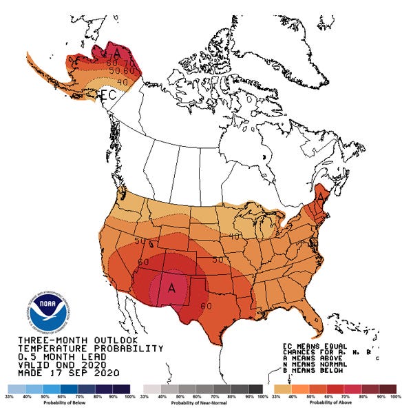
TEMPERATURE FORECAST: This is the forecast map for the 90 days from mid-September to mid-December from the Climate Prediction Center shows above-normal temperatures are in the forecast for most of the nation.

That forecast map from Sept. 17 predicts that over the next 90 days, Kansas weather — and much of the southern half of the U.S. will be drier and warmer than normal. The same forecast for the shorter term of just the next 30 days, however, predicts drier and cooler temperatures than normal.
About the Author(s)
You May Also Like


