February 10, 2020

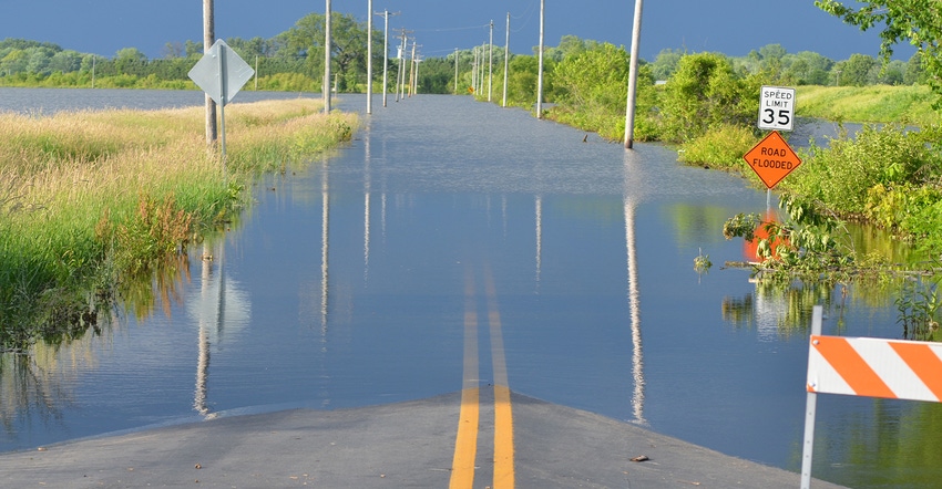
This year’s snowmelt in the Northern states will run off and head to Missouri. However, much of the state’s soil is already saturated.
“The pressing situation is exceptional wetness across the Missouri River and upper Mississippi River basins,” says Pat Guinan, University of Missouri Extension climatologist. A new report from meteorologists in the north-central U.S. raises flooding issues, he says, but it refrains from firm forecasts.
A 2019 flood repeat isn’t guaranteed, the report notes. There is time and factors to come together before climatologists know how bad, or uneventful, it becomes.
Unsettled forecast
Missourians farming along rivers recall last year’s record floods, high rivers and super wet ground. They’ll watch changes from winter to spring across the state this year.
Changes could include dry, warm weather allowing soils to drain and dry; little or no added snowfall with cold snaps; or a gradual move from winter to spring with mild temperatures making a slow snowmelt. All of those cut flood risks.
However, other possible changes between now and April are not good, the meteorologists report.
Above-normal snowpack across the basins could grow. A long, widespread cold snap may freeze the ground and build thick layers of river ice. That increases ice jams. Or heavy rain on snowpack could rapidly release more water. These changes could delay or prevent crop planting.
Statistics tell story
Guinan makes no forecast on how the spring weather will develop. As a climatologist, he says he’s better at looking back. Past records help us understand conditions.
December 2019 showed above-normal temperatures during most of the month. The statewide temperature was almost 6 degrees F above long-term average. That made it the ninth-warmest December on record.
In the tradition of Missouri’s erratic weather, 2019 had six months each of below-normal and above-normal temperatures. December was the state’s driest since 2017, yet Missouri had eight wetter-than-average months during 2019.
January 2020 data isn’t tallied. It surely won’t match December’s temperature departures, although it will be above normal. Average precipitation for the year was 53.78 inches. That makes 2019 the state’s seventh-wettest year on record.
Meanwhile, bottomland farmers keep watch on the weather heading into spring. They hope for no topping of 2019 records. To keep up to date with both Missouri and Mississippi River data, visit agebb.missouri.edu/weather/river.htm.
Source: The University of Missouri Extension, which is solely responsible for the information provided and is wholly owned by the source. Informa Business Media and all its subsidiaries are not responsible for any of the content contained in this information asset.
You May Also Like


