Subscribe to receive top agriculture news
Be informed daily with these free e-newsletters

Tropical storm watch in Texas stirs memories of Hurricane Harvey disaster; ranchers and farmers warned to be ready for storm event
September 12, 2018
It’s been a little over a year since Hurricane Harvey slammed into the Texas coast near the end of Aug. 25, leveling homes and communities and dropping a record 60-plus inches of rain on parts of coastal Texas.
While recovery has been progressive, it is far from over as cities like Port Aransas and Rockport are still struggling to restore infrastructure, some businesses still remain closed, and some relocated homeowners are still waiting for insurance claims to be settled before rebuilding from their damages.
See, Hurricane developments: When it rains it pours
As a new tropical system continues to brew in warm Gulf waters this week, Texas AgriLife Extension officials are reminding livestock producers to take time to review their operational plans in anticipation of heavy weather expected on the Texas coast as early as Friday,(Sept. 14.
“While a lot of producers remember well the difficulties caused by Harvey last year, we’re hoping this new system in the Gulf is not going to be anything like what we went through last year,” says Jason Cleere, associate professor & Extension Beef Cattle specialist for Texas AgriLife. “That being said, folks located in low-lying areas should be concerned and taking measures now to prepare ahead of a storm and any heavy rain events. We already have water standing in some pastures, especially along the coast.”
Cleere and Texas A&M AgriLife and Nueces County Agent Jason Ott says farmers and ranchers should remember online resources available to help them prepare for storms and other disasters.
See, Farmers in Hurricane Florence’s path race to cushion the blow
“The best place to get good information about preparation on the farm and ranch is at Texashelp.tamu.edu where they will find a checklist of options and advise,” Ott said. “While there’s not a lot of time to prepare before this particular storm event, reviewing their options is well advised, especially after what so many went through last year during Hurricane Harvey’s tragedy.”
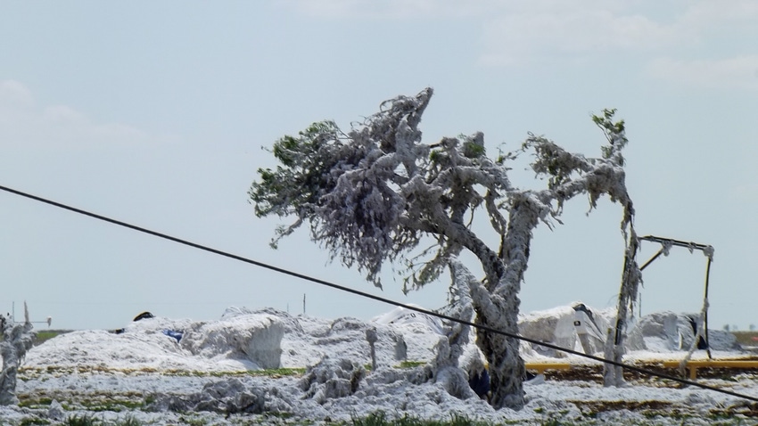
Last year, on Aug. 25, 2017, Category 4 Hurricane Harvey hit Port Aransas and Rockport with sustained winds of 130 mph and gusts as high as 150 mph. While wind damages were significant across a large area of the Texas mid-coast, the record-breaking downpours that followed for several days after the system stalled, dropping in excess of 60-inches of rain in parts of Southeast Texas, caused additional losses of property, crops and livestock.
See, Remembering Harvey
One of the greatest tragedies for Texas agriculture was the loss of livestock across at least 35 Texas counties, and the destruction of cotton bales still in turn rows as the storm moved into coastal areas. No final or definitive estimate of those losses are available, but overall, Harvey’s total destruction has been estimated at $125 billion, the second most costly storm in U.S. history. An estimated 13 million people were affected by the storm, nearly 35,000 homes were damaged or destroyed in the historic flooding that lasted for nearly a week, and a million cars were wrecked. The death toll to Harvey stands at 88.
Now, with those memories still fresh in the minds of coastal communities and their residents, forecasters are calling for another tropical system that, as of this writing, is expected to slam into the Texas coast at about the same spot that Harvey made landfall as early as this Friday. While it is too early to forecast the exact point of landfall yet, the current models indicate the track of the storm appears to target the area around Corpus Christi.
On the positive side, forecasters currently believe the system, while expected to strengthen to tropical storm level before arriving on the Texas coast, is currently expected to have maximum wind speeds of 60 mph. However, National Weather Service and FEMA officials are warning the system could stall and strengthen, and is expected to trigger a significant rain event regardless of storm level, causing coastal and inland flooding. Over the recent week, the Coastal Bend of Texas has received significant amounts of rain, raising concerns that soils are already saturated, and some rivers and streams are already near flood stage.
“Because of dry conditions throughout much of the summer season, hay resources have been a little tight in some areas,” warns Ott. "If producers can find hay ahead of this storm, it would be a good idea to have enough on hand for a few days in the event flooding in fields and pastures should occur.”
Cleere suggests livestock producers make certain cattle have access to higher ground if possible, or in the event of small herds or horse operations, they might consider moving animals to areas out of harm’s way.
“In some extreme cases that might mean cutting fences to allow cattle to reach high ground, and that would be better than having them trapped and perish because of restricted movement,” he said.
Ott suggests producers could consider communicating with other producers if the need to move livestock becomes necessary.
“A lot of times a trailer will be half full before leaving, and that trailer space could be used by a neighbor, so checking with other producers in your area might also be a good idea as you prepare for a storm."
While no one expects the approaching tropical system will be anything like Hurricane Harvey, producers are reminded, when it comes to weather systems, things can change rapidly, so having a plan of action ready is the best defense against getting caught “out in the cold,” or in this case, the wind and the rain.
You May Also Like
Enter a zip code to see the weather conditions for a different location.


