La Nina conditions in the Pacific Ocean may lead to the second straight drier-than-normal winter in much of the West, as a blocking high-pressure ridge could set up off the California coast and potentially worsen an already developing drought, forecasters say.
The National Oceanic and Atmospheric Administration’s winter forecast favors warmer, drier conditions across the southern tier of the U.S. and cooler, wetter conditions in the north. This is due largely to La Nina, in which slightly below-normal sea surface temperatures lead to a high-pressure ridge that moves the storm track to the north.
The condition is marked by colder storms that can increase precipitation in the Pacific Northwest and, if the La Nina is strong enough, Northern California. But with the weak La Nina that’s expected to persist until next summer, chances are that California and the Southwest will experience another dry winter.
“For the majority in the state, more often than not La Nina conditions result in below-normal precipitation,” said Cindy Matthews, the National Weather Service’s chief forecaster in Sacramento. However, a drier-than-normal winter “does not preclude a single storm showing up and causing flooding,” she said during a recent virtual meeting with reporters.
According to the federal Climate Prediction Center, wetter-than-average conditions are likely to extend east from the Pacific Northwest, while the greatest chances for drier-than-average conditions are predicted in the Southwest, across Texas and along the Gulf Coast.
In much of California, the CPC gives equal chances of wet, normal or dry weather through February. “There’s more of a chance that temperatures will be above normal and precipitation below normal,” Matthews said.
Drought develops
Currently, large areas of drought extend over the western half of the U.S., with parts of the Northeast also experiencing drought and near-record low stream flows, NOAA reports. As of early November, the U.S. Drought Monitor showed parts of Northern California, large swaths of western and central Oregon and nearly all of Arizona as being in extreme drought.
Formal drought declarations have been issued this year for several areas, including southern Oregon counties and numerous Washington watersheds. But National Weather Service officials caution that the drought in California is still “small D,” meaning there hasn’t been a formal state declaration, which triggers disaster aid.
With a La Nina climate pattern in place, drought may expand and intensify in southern areas during the winter months, forecasters warn.
“With La Nina well established and expected to persist through the upcoming 2020 winter season, we anticipate the typical, cooler, wetter North, and warmer, drier South, as the most likely outcome of winter weather that the U.S. will experience this year,” said Mark Halpert, the Climate Prediction Center’s deputy director.
The forecast comes as the water year that ended Sept. 30 saw a lack of precipitation resulting in a snowpack in California of just 50% of average on April 1, as measured by a state snow survey program. The lack of snowfall made for the 10th smallest snowpack in the Golden State since 1950, according to the state Department of Water Resources.
On average, California sees five to seven “atmospheric river” mega-storms in a season, Matthews said. The state got 13 in 2019, a wet year. But of the nine atmospheric rivers that hit the West Coast in water year 2020, only one brought significant rain to California, Matthews said.
“That is a huge contributor to why we were dry,” she said.
Less runoff recorded
California’s reservoirs received just one-third of the water runoff from precipitation and snowmelt that they did during the same period a year earlier, the agency noted. But the impacts were tempered because of good reservoir storage from a wet 2019, from which the statewide reservoir storage at the end of September 2020 was still about 93 percent of average or 21.5 million acre-feet.
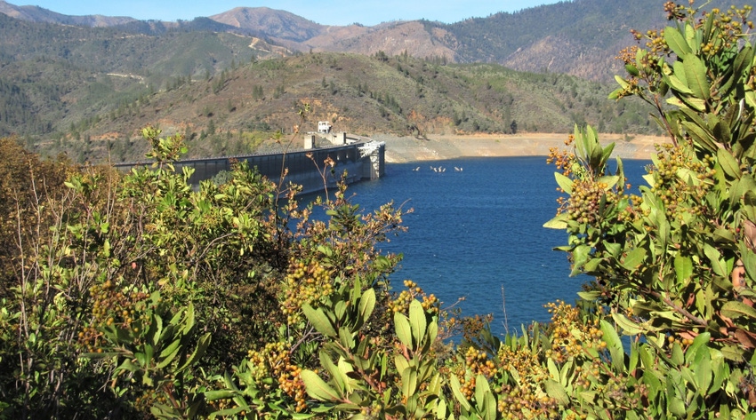
The water levels of major reservoirs have been dropping, however. As of Veterans Day, Shasta Lake, the centerpiece of the federal Central Valley Project, was at 42% of capacity and 63% of average for the date, according to the DWR’s California Data Exchange Center. Lake Oroville, the State Water Project’s main reservoir, was at 36% and 56%, respectively.
In the water year that started Oct. 1, many areas are off to a slow start in terms of precipitation. As of Nov. 11, Sacramento had received only a trace of rain, well below its seasonal average for the date of 1.53 inches, according to the weather service. Fresno had recorded 0.11 inches of rain, significantly below its average of 0.96 inches as of Veterans Day.
“We can usually make two and sometimes three years of survival for water supply and irrigation purposes from water in reservoirs before we have to start making major cuts and major water conservation efforts,” Matthews said.
High-pressure ridge
Talk of a building high-pressure ridge off the coast inspires memories of California’s historic 2012-2016 drought, during which a stubborn wall of high pressure seemed almost permanently established. The drought cost California’s agricultural economy more than $5.2 billion, fallowed more than 1 million acres and caused the loss of nearly 40,000 agricultural jobs during its peak in 2014-2016, according to the Center for Watershed Sciences at the University of California, Davis.
Many farmers made do without surface water by relying on groundwater, but that won’t be as much of an option next time under restrictions from the Sustainable Groundwater Management Act.
With blocking ridges associated with La Nina, it depends on how close the ridge is to the coast, Matthews said. If the system is a ways out, storms can veer around it and still reach California from the north, she said. If the ridge is just off the coastline, cold storms can dump copious snow in the Rockies but leave California dry.
“Seasonal outlooks don’t capture how wet or dry the winter will be,” Matthews cautioned. “That’s determined by individual storms throughout the season.”
About the Author(s)
You May Also Like


