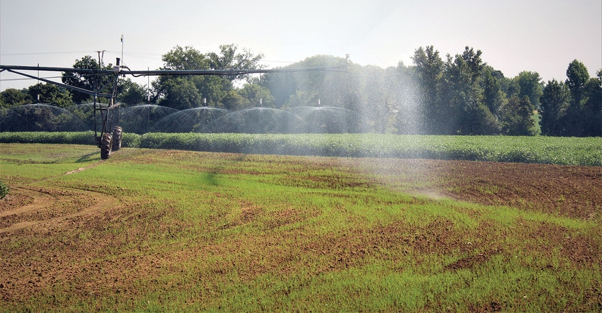
The Mississippi Alluvial Valley Aquifer (MAVA) and the Ogallala Aquifer have for decades supplied water to the Mid-South and Southwestern United States — two of the largest cotton production regions in the Cotton Belt. Water pulled from these aquifers for row crop irrigation increases yields, but because the use rates at which these two aquifers are currently being drawn down are not sustainable, the future of water availability for farming operations in these two regions is uncertain.
Dr. Jeannie Barlow, deputy director, U.S. Geological Survey, Lower Mississippi-Gulf Water Science Center, and Kristine Blickenstaff, supervisory hydrologist, Texas Water Science Center, Fort Worth, Texas, will discuss the increasing pressure on these two aquifers and the impact on production agriculture during the Consultants Conference at the 2020 Beltwide Cotton Conferences in January.
Barlow will address the latest developments regarding the Mississippi Alluvial Plain (MAP), and Blickenstaff will talk about the future of water availability from the Ogallala aquifer.
The Ogallala
Dr. Robert Mace, head of The Meadows Center for Water and the Environment, knows the Ogallala supplies 40 percent of the water to the entire state of Texas. He also knows it supplies 99 percent of the water for the irrigated agriculture. “In Texas, we are pumping water out of the Ogallala at a rate six times faster than we believe water is coming back in,” says Mace. “On average, the Ogallala is dropping about a foot each year.”
Agriculture’s annual contribution to the Texas economy, measured in gross domestic product, is about $2.5 billion. “The farm gate value (total cash receipts) is around $2 billion,” says John Robinson, professor and Extension economist, Agriculture and Life Sciences, Texas A&M University.
According to Mace, the average thickness of the Ogallala is about 100 feet. “Permian rocks form the bottom of this aquifer and they are not very water transmissive,” says Mace. “I equate it to the bottom of a bathtub. You have your water table and the distance from the top of that water table to the bottom of the aquifer is its saturated thickness.”
Many parts of the aquifer where farmers once pumped water for irrigation are now dry, and those areas are growing as time passes. “We have estimates that tell us that the lobe of the aquifer south of Amarillo has about 40 years of supply remaining if current pumping rates continue, and it will probably be less than that because the economics of pumping for ag irrigation will be exhausted long before the aquifer will dry up,” says Mace. “What I mean by that is when that saturated thickness gets down to 20 or 30 feet, farmers won’t be able to afford enough wells to pump their needed amount of irrigation water and the only other option will be deficit irrigation, which may eventually lead to dryland farming.”
Aquifer recharge options, like modifying the 20,000 playa lakes across the state to increase infiltration rates, have been studied but it was determined that option would have little recharge effect. “Not to mention that modifying playa lakes puts a farmer’s ability to benefit from government programs in jeopardy because those lakes are recognized as wetlands,” says Mace. “Long ago, the idea of piping water from the Mississippi River over to the High Plains was suggested, but the costs and legal hurdles would be exorbitant.”
Mississippi River Valley Alluvial Aquifer
Dr. Barlow understands the reality of the situation the Mississippi River Valley Alluvial Aquifer (MAVA) is in and continues to help guide research efforts to evaluate options for its re-charge. “The agricultural economic impact from the region across the Mississippi Alluvial Plain (MAP) generates over $6.5 billion dollars annually,” says Barlow. “To maintain that impact on that region’s economy, a sustainable water source is paramount.”
Due in part to the nature of its soils, the Delta has a high percentage of runoff. The MAVA is made up of the right materials to effectively hold water, but over time its water level has dropped and a considerable “cone of depression” in the part of the aquifer over the Mississippi Delta has developed. “Because we have more water coming out of the aquifer than is going into it, we have seen the section of the aquifer around the Sunflower, Miss., area declining at a rate of 1 foot per year,” says Barlow. In addition to threatening the future availability of water supply from the MAVA, water level declines have also resulted in decreases in baseflow in many streams across the Delta to the extent that in the absence of rainfall or irrigation return flow, some stream reaches are dry during the summer months.”
Through aerial mapping data, Barlow and her team are creating a hydrogeologic model to develop a clear understanding of the aquifer’s permeability, porosity, and hydraulic conductivity. This model, along with an economic model to address potential costs, will be used to evaluate each project under consideration that can be used to improve the status of the aquifer.
For more information about the 2020 Beltwide Cotton Conferences see: https://bit.ly/2khR5yk.
About the Author(s)
You May Also Like


