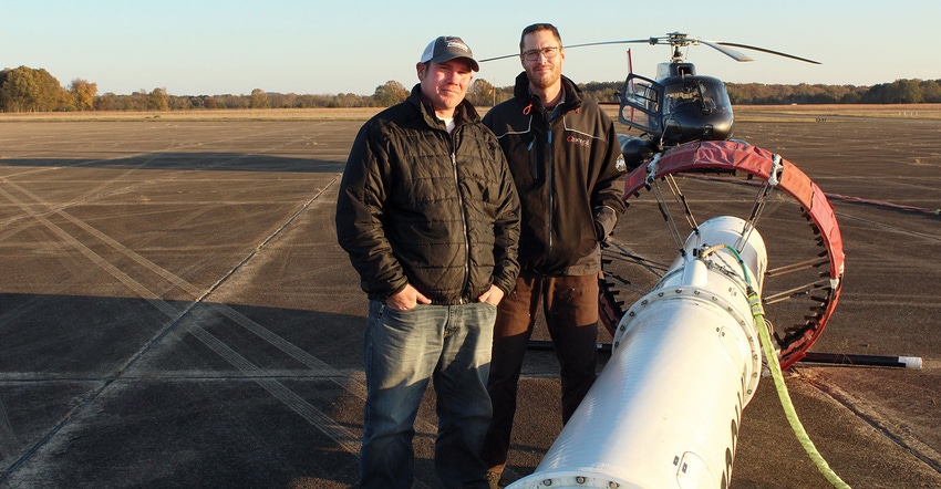
If you saw a helicopter with a huge tube tethered underneath flying low across rural sections of the Mid-South the last several months, you witnessed part of a groundbreaking research project designed to reverse the unsustainable water-use levels of the Mississippi River Valley Alluvial Aquifer (MRVAA) to help ensure irrigation water for future generations of Delta farmers.
To date, the Canadian-based helicopter crew has flown more flight line kilometers in this area and accumulated more geological data than had ever been done before in the United States.
Dr. Jeannie Barlow, assistant director, Water Availability and Use Studies, U.S. Geological Survey, Gulf Water Science Center, gave a briefing about the ongoing work and research progress made to date at the Delta 1000 meeting prior to the recent Delta Council Annual Meeting in Cleveland, Miss. “The agricultural economic impact from the region across the Mississippi Alluvial Plain (MAP) generates over $6.5 billion dollars annually,” says Barlow. “To maintain that impact on that region’s economy, a sustainable water source is paramount.”
The aquifer and models
The MRVAA is made up of the right materials to effectively hold water. It is not extremely deep and is one of the top three aquifers in the nation used for agriculture — now recognized as the second most-used aquifer, surpassing the Central Valley aquifer in California. But this use comes at a cost.
Over time, the aquifer’s water levels have been changing. “We have a considerable cone of depression in the Mississippi Delta and we’re worried about more of them developing as more water is pumped from the aquifer,” says Barlow. “The areas around the Central Delta, specifically around Sunflower, Miss., are where we have seen the aquifer declining at a rate of one foot per-year.”
The Delta, Barlow notes, is fortunate to get plenty of rain that increases the water budget, or the cumulation of all the precipitation it receives and where it ends up. Water run-off and water re-charge can be compared to adding money to a banking account. “The Delta has the highest percentage of runoff, probably due to the nature of its soils,” says Barlow. “The problem is, right now we have more water going out of the system than is going into the system.”
All of the inputs, like water from the flood hills east of the Delta, and the Mississippi River to the west, plus some exchange from exterior streams, are relatively small compared to the major output from farming irrigation. Huge amounts of collected field data are being connected with models Barlow and the other project collaborators are utilizing to develop scenario solution options.
Budget and monitoring models being used will increase the model’s overall efficiency and accuracy. A hydrogeologic model will be used to illustrate the texture of the aquifer, or, what it looks like inside. “We have to gain a clear understanding of the aquifer’s permeability, porosity, and hydraulic conductivity which controls the flow of water underground and how it exchanges with our streams,��” says Barlow. ‘That information is much more important than we thought initially.”
Economic model
Dr. Larry Falconer, Extension professor, Mississippi State University, developed the economic model being used to assign costs to each part of the project. “We currently have 90 voluntary metering program sites sending data to our scientists at 15-minute intervals,” says Barlow. “This is groundbreaking aquifer research not being done anywhere else, and the farmers and landowners across the region, the stakeholders, are playing a key role in allowing us to conduct this research.”
Scientists are now taking data accumulated from the helicopter and, via computer animation software, are generating layered images of the aquifer to depths of 300 feet. That data will be incorporated into the models. “This is an active modeling exercise,” says Barlow. “Everything we put into the model is dynamic.”
Processes Barlow described during her presentation currently fall under a Scenario Analysis, which is telling the model what to do based on inputted data. “We are moving toward Optimization Analysis where we tell the model what we need, the current options, and related costs,” says Barlow. “The model will then run itself thousands of times and spit out a suite of options to meet those needs and follow any relevant constraints. Those options will eventually be used by the Governor’s Task Force to make decisions moving into the future.”
Another phase of data collection will begin this summer when a fixed-wing aircraft, replete with instrumentation mounted on its wing, will fly grid patterns to gather information to fill any needed existing data gaps. A website is planned in the near future to keep the stakeholders and the general public aware of the latest research.
About the Author(s)
You May Also Like


