Subscribe to receive top agriculture news
Be informed daily with these free e-newsletters

Ogallala Aquifer levels are dropping at a more accelerated rate than expected
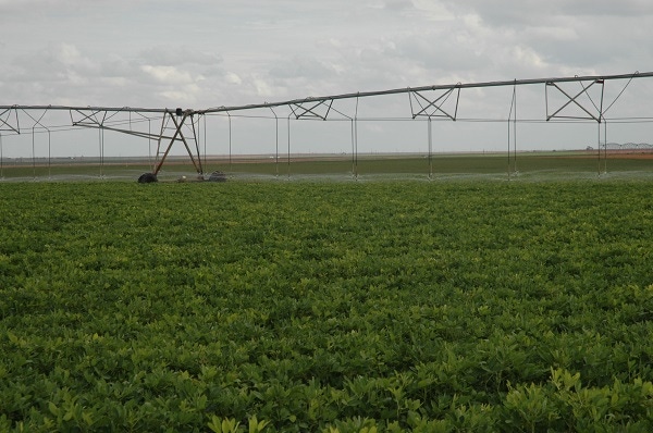
As a reasonably good year for crops across the Texas High Plains comes to a close and thoughts turn to the 2015 crop planting season, a special U.S. Geological Service (USGS) report released this month is raising warnings over an already worrisome water profile for the Ogallala Aquifer, one of the world's largest shallow water table resources and the primary source of water used for crops in large areas of eight different West and Midwestern states.
With multiyear periods of severe drought and heavy irrigation across much of the High Plains in recent years, water shortages are no surprise to farmers and ranchers up and down the aquifer. But according to the USGS report released last week, aquifer levels are dropping at a more accelerated rate than expected, raising concerns water shortages may get worse in the years ahead than previously forecast.
"The measurements made from 2011 to 2013 represent a large decline," said Virginia McGuire about the report's findings. McGuire is a USGS scientist and lead author of the study.
"This amount of aquifer depletion over a two-year period is substantial and likely related to increased groundwater pumping."
The aquifer underlies nearly 112 million acres (about 175,000 square miles) in parts of eight States—Colorado, Kansas, Nebraska, New Mexico, Oklahoma, South Dakota, Texas, and Wyoming. Scientists say water-level declines began in parts of the High Plains aquifer soon after the beginning of substantial irrigation with groundwater in the aquifer area in the early 1950s.
The report presents water-level changes in the High Plains aquifer from early pre-development—generally before 1950—to 2013 and from 2011 to 2013. It also presents change in water in storage in the High Plains aquifer from pre-development to 2013 and from 2011 to 2013.
The USGS study used water-level measurements from 3,349 wells for pre-development to 2013 and 7,460 wells for the 2011 to 2013 study period.
The USGS, at the request of Congress, has published reports on water-level changes in the High Plains Aquifer since 1988. Congress requested the reports in response to substantial water-level declines in large areas across the aquifer dating back to the early 1980s.
McGuire said the total water stored in the aquifer in 2011was about 2.92 billion acre-feet, an overall decline of about 267 million acre-feet (or 8 percent) since pre-development. Change in water stored from 2011 to 2013 was an overall decline of 36.0 million acre-feet. The overall average water-level decline in the aquifer was 15.4 feet from pre-development to 2013, and 2.1 feet from 2011 to 2013.
“This multi-state, groundwater-level monitoring activity tracks water-level changes in all eight states through time and has provided data critical to evaluating different options for groundwater management," said McGuire. "This level of coordinated groundwater-level monitoring is unique among major, multi-state regional aquifers in the country."
She said the methods to calculate area-weighted, average water-level changes — change in water in storage, and total water in storage for the new report — used geospatial data layers organized as rasters with a cell size of 500 meters by 500 meters, an area of about 62 acres. These methods were used to provide a raster dataset of water-level changes for other uses.
USGS reports the area overlying the High Plains aquifer is one of the nation’s primary agricultural regions. In parts of the area, farmers and ranchers first began extensive use of groundwater for irrigation in the 1930s and 1940s. Estimated irrigated acreage was about 2.1 million acres in 1949, 13.7 million acres in 1980, 13.9 million acres in 1997, 12.7 million acres in 2002, and estimated to be about 15.5 million acres in 2005.
In 2005, about 14 percent of the aquifer area was irrigated, not including the areas with little or no saturated thickness.
The report concludes that groundwater withdrawals from the High Plains aquifer for irrigation increased from 4 million acre-feet to 19 million acre-feet from 1949 to 1974 and groundwater withdrawals for irrigation in 1980, 1985, 1990, and 1995 were 4 percent to 18 percent less than withdrawals for irrigation in 1974.
By 1980, water levels in the High Plains aquifer in parts of Texas, Oklahoma, and southwestern Kansas had declined more than 100 feet.
The report further concludes changes in the static water-level of an aquifer result from an imbalance between discharge and recharge. The static water level in a well is the water level after recovery from pumping in the measured well or in nearby wells.
Discharge from the High Plains aquifer primarily consists of groundwater withdrawals for irrigation but also includes groundwater withdrawals for public water supply and other uses; evapotranspiration where the water table is near land surface; and seepage to streams, springs, and other surface-water bodies, where the water table intersects the land surface.
The report is available online and can be accessed here.
You May Also Like
Current Conditions for
54°F
Mostly Cloudy
Day 64º
Night 51º
Enter a zip code to see the weather conditions for a different location.


