Subscribe to receive top agriculture news
Be informed daily with these free e-newsletters

La Nina may replace El Nino this summerEl Nino could bring more extreme weather before disappearing
With the summer growing season upon us, producers have a lot to think about. Like every year, they're thinking about their finances, including things like loans at the bank and terms for cash rents or crop sharing. What producer isn't constantly thinking about input costs, especially early in the season, and wondering if spring is here to stay or is a change in the weather just ahead?
With the erratic weather of the past few years still fresh in our minds, it may be the weather that crosses our thoughts the most this spring. We've already had some violent outbreaks of assorted weather varieties early this season, from tornadoes in the South and floods, hail and fire storms across the Southwest, and now there is one more weather concern to consider as forecasters ramp up speculation over whether a La Nińa will form as the current El Nińo begins to fade once summer arrives.
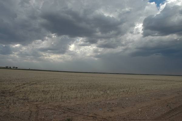
La Nińa systems usually means hot and dry days with little or no rain, a condition that producers know well after the multiyear drought at the beginning of the decade.
National Weather Service (NWS) climate specialists are keeping an eye on possible changes over the Pacific Ocean where cooling is expected to develop by summer, a certain sign that a La Nińa weather pattern may be forming and could result in extreme heat and an abnormally dry outlook for the peak of the summer season.
NWS forecasters say it is not unusual for a La Nińa event to follow on the heels of an El Nińo system. The following table illustrates the relationship between the two opposing events:
El Nińo La Nińa
1982-83 1984-85
1987-88 1988-89
1994-95 1995-96
1997-98 1998-99
2006-07 2007-08
2009-10 2010-11
(Source: U.S. National Weather Service Climate Prediction Center)
If the same holds true for this year, above-normal-temperatures and lower-than-normal rains could prove to dry out much of North America by July, causing stress on the farm and ranch after two years of respite from drought.
Like all weather, local conditions can vary greatly, and just because there is a chance of a developing La Nińa this year, that doesn't mean it will present drastic weather conditions uniformly across the nation.
In fact, since La Nińa systems seem to encourage tropical weather development in the Atlantic Basin, it is possible that such an event could generate an abundance of rainfall for Gulf Coast states, depending on tropical storm development.
But La Nińa is broadly associated with lower rainfall in the eastern Pacific and higher rainfall in the western Pacific, which can have an adverse effect on many U.S. grain growing areas, as was the case in the drought year of 2012 when U.S. corn yield fell to a 17-year low of 123.4 bushels per acre. A similar drought in 2008-09 sent Argentine soybean production slumping by nearly 30 percent.
Meteorologists note that of the eight strong El Nińo events since 1950, the three strongest all transitioned rapidly into a dry, La Nińa summer. Forecasters say as the El Nińo winter comes to an end, spring ocean temperatures will be a key to judging the risk of a strong La Nińa in the weeks ahead.
If forecasters are right and a La Nińa follows on the heels of the current El Nińo, it will be the first time for it to emerge over the last four years.
But exactly what does it mean if La Nińa returns this summer?
It depends on the year, or better stated, the intensity of the La Nińa weather pattern. Last time it appeared from August 2011 to March 2012, it hurt corn and soybean crops in Argentina and Brazil, brought the worst drought in a century to Texas and the Southwest, and increased the number of storms that threatened U.S. coastal regions, including Hurricane Irene.
But - hold on to your hats - La Nińa may not be the only weather worry producers are facing this season. The National Weather Service's Climate Prediction Center's resident El Nińo/La Nińa expert, Michelle L'Heureux, says the current El Nińo may not be going away without some additional heavy weather development. She says it will likely keep affecting temperature and precipitation patterns across the United States until early summer before giving way to that possible La Nińa event.
You May Also Like
Enter a zip code to see the weather conditions for a different location.


