Subscribe to receive top agriculture news
Be informed daily with these free e-newsletters

The National Weather Climate Prediction Center is saying the chances for the odds of an El Niño return now stands at about 50-50, but other meteorologists are saying conditions are improving that could increase those chances in the weeks ahead.
Most everyone knows that forecasting the weather in advance is a crapshoot. Like in Vegas, you can roll the dice as many times as you want but getting a seven or eleven every few roles doesn't make you a winner all the time.
From the East Coast to the West and from the southern border to Canada, spring is finally shaping up for farmers. In the south much of the seed has already hit the soil and in south Texas the corn and sorghum are reaching knee high in a few places.
Tractors are rolling and the fields are active, or soon will be in most farming states as spring blossoms across the nation. Even early spring grasses and wildflowers are reaching for the sky in some places as working day gets longer as the sun slower to set.
With all this work and preparation going on, most farmers are too busy to think about anything farther down the road than next week or so. But while few may be talking about it, just about every farmer is wondering what the weather will hold in store as the spring season progresses and the heat of summer quickly approaches.
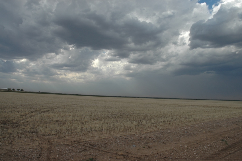
The general forecast is calling for continuing drought for the West and Southwest, including large parts of Texas. But the National Weather Service, independent weather forecasters and even university weather scientists are beginning to hint at the probability of a developing El Niño, or ENSO (El Niño Southern Oscillation) event in the Pacific by mid-to-late summer this year that could bring some weather changes to the Southwest, including an increased chance of rain in the mountains.
The National Weather Climate Prediction Center is saying the chances for the odds of an El Niño return now stands at about 50-50, but other meteorologists are saying conditions are improving that could increase those chances in the weeks ahead.
The phenomenon known as ENSO is characterized by fluctuations in the water temperatures of the tropical Pacific Ocean. An El Niño means warmer than normal water while a La Niña provides cooler than normal water.
What kind of weather changes we could expect and how drastic those changes might be depend on multiple factors. The location of your farm or ranch for one, and influences from other climate factors like water temperature, winds aloft and an ever-shifting tropical jet stream.
National Weather Service (NWS) meteorologist Brian Guyer in Albuquerque says spring has started out across the Southwest with exceptionally dry conditions across parts of eastern New Mexico and into the Texas Panhandle. But he warns high winds continue to keep conditions on the dry side and that could be reminiscent of the Dust Bowl days if conditions persist.
Guyer admits though that there seems to be an improving chance for an ENSO event but warns it could come early or exceptionally late into the fall -- probably too late to provide much benefit to agriculture. But on the optimistic side, he says El Niño could set up an active monsoonal season in the mountains, especially around the Four Corners region. But even a late developing El Niño could bring a wet cold season, and that could mean heavier snowfall at higher elevations that could bring help for the spring of 2015.
The other major consideration of a summer-forming El Niño is its affect on the tropical season. Such events generally create high wind shear aloft in the Eastern Atlantic that can often break up tropical systems rolling off the coast of Africa. But in contrast, they could have little affect on the Caribbean and the Gulf which can be tropically active and the source of storm formation as water temperatures rise.
The most promising early El Niño forecast comes from Accuweather Long Range Forecaster Mark Paquette.
"We are confident that an El Niño is in the early stages of developing and may reach moderate strength moving forward into mid- to late summer of 2014," he reported earlier this week.
While hurricane season could bring rains to the Gulf Coast areas and could even pump moisture to points north, east and west, a lack of tropical activity across the Atlantic could also mean less moisture for the Deep South. But another possible rain benefit could come from the formation of tropical systems off the Pacific coast of Mexico that could stream moisture into Texas and the Southwest.
The National Oceanic and Atmospheric Administration (NOAA) issued an "El Niño Watch" in early March, and analysts, in a report, recently said conditions for ENSO development is increasing in the Pacific.
"During the last month, the SST (sea surface temperature) anomalies were increasingly positive in the eastern Pacific and near the International Date Line," the report indicated.
While most everyone remains suspicious of long-range forecasts, many say they are anxiously awaiting the first pre-season hurricane and summer season forecasts that are due to come out in the weeks ahead. While nothing can be written in stone this early in the game, any good sign of possible moisture is a welcome one when it comes to high hopes for rain when summer finally arrives.
You May Also Like
Current Conditions for
51°F
Partly Sunny
Day 52º
Night 36º
Enter a zip code to see the weather conditions for a different location.


