June 3, 2016

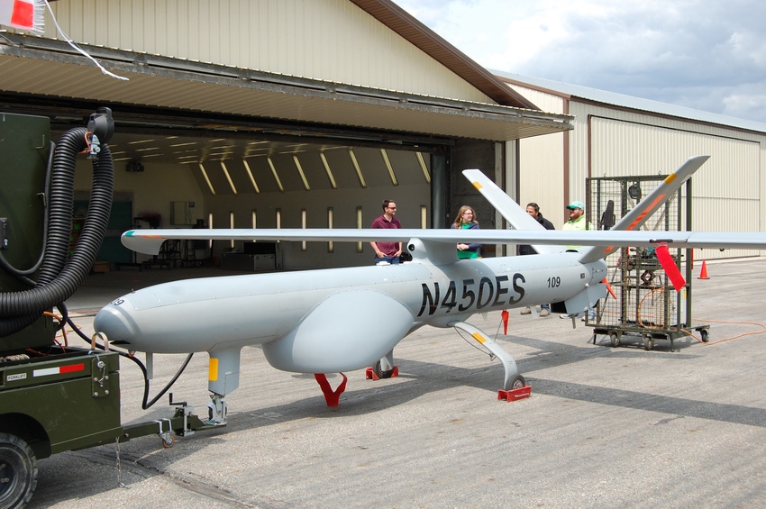
North Dakota State University is testing a UAV with a 35-foot wingspan for use in agriculture.
Small UAVs are ideal for scouting crops and livestock and can be used effectively to capture imagery for precision management decisions such as variable-rate in-season fertilization, weed identification, livestock inventory and identifying sick animals, says John Nowatzki, Extension agricultural machine systems specialist and the principal investigator on this project.
But small UAVs are relatively limited by flight time and cannot easily capture imagery of thousands of acres on the same day, he says
“Large UAS will be needed to collect high-spatial and temporal-resolution imagery over entire regions in a timely manner,” he says.
One of the benefits of using UAVs for agricultural purposes is saving time, but if a producer has to drive a small UAS from field to field, then it really isn’t much of a time saver, notes Sreekala Bajwa, chair of NDSU’s Agricultural and Biosystems Engineering Department and a co-investigator on this project.
“Most small UAVs need to capture hundreds of individual images to make a single mosaicked image of one square mile,” Nowatzki says. “A large UAS could capture high-resolution imagery of one square mile in a single image. This would make it possible to capture imagery useable for precision crop management over hundreds of thousands of acres in a single day at very high resolution.”
NDSU is using the Hermes this summer to collect imagery from a 40 mile corridor in eastern North Dakota. It will fly ever week at altitude of 3,000-, 5,000- and 8,000-feet. NDSU researchers hope to collect data on stand counts in corn, sunflowers and sugar beets; the effectiveness of nitrogen applied to corn and wheat; iron chlorosis deficiency in soybeans; and yield predictions for corn, soybeans, wheat, sugar beets and sunflowers. They will also see if the UAV also can benefit livestock producers, such as by inventorying cattle in pastures.
Research plan to compare the data collected from the air at various altitudes with data collected through satellite imagery, in-field observations and on-the-ground
“This research is the first of its kind in the nation,” Bajwa says.
Source: NDSU Extension
About the Author(s)
You May Also Like


