

Subscribe to receive top agriculture news
Be informed daily with these free e-newsletters

Slideshow: Thermal imagery from the air offers early insights for prescriptions and diagnoses for crop issues.
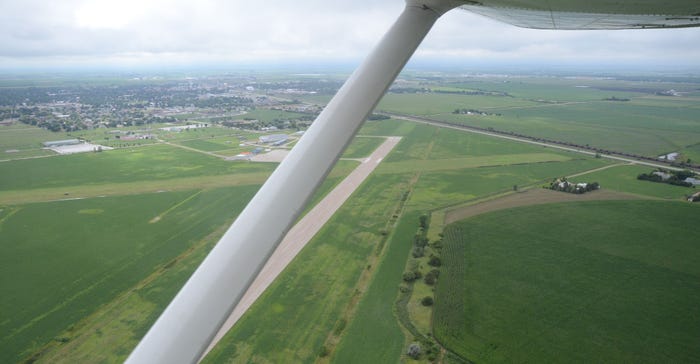
For a town of just over 10,000, Lexington, Neb., has a busy airport. The Jim Kelly Field Airport west of town sees a 20,000 take-offs and landings each year.
Many of them are light aircraft — single-engine Cessnas, Beechcrafts, Pipers and Cirruses. But there are several business-class jets, and even a few older warbirds that land at the airport on their way to and from the Oshkosh Air Show in Wisconsin.
Many of those single-engine planes fly in and out for agricultural purposes, and about 30 of these 20,000 flights are to collect aerial imagery for AirScout. Don Masten, whose son Nathan manages the airport, is one of those pilots.
Don Masten has been a pilot since 1978 but didn't begin collecting aerial imagery for agricultural purposes until he began flying for AirScout in 2013.
In the last several years, AirScout has expanded its footprint in Nebraska, offering services and aerial imagery captured by manned aircraft across the state. Masten typically recruits pilots from the University of Nebraska-Kearney's flight training program to fly fields, allowing them to log more hours toward their pilot licenses.
“A number of years ago I was looking for infrared cameras light and precise enough to mount to a drone and get a view that was commercial-scale," Masten says. "As I explored it, I realized several things: the infrared equipment that was sensitive and precise enough for our purposes was very expensive and heavy, and drones wouldn't be able to carry that kind of load. I dropped it, because it wasn’t feasible. A few months later, out of desperation, I Google-searched 'aerial-based thermal imaging' and AirScout came up."
That led to a phone conversation with Brian Sutton, founder of AirScout and an Indiana farmer.
“Brian was very interested in getting someone in this part of the country to do it," Masten says. “You’ve got to have the airplanes and they have to be flown on a regular basis.”
A different view
Sutton, a commercial airline pilot, bought his first near-infrared camera in the 1990s to measure normalized difference vegetation index. However, NDVI fell short of his expectations of amplifying issues he couldn't already see in his crop fields. After trying numerous filters without success, he found what he needed in 2010: a microbolometer, a kind of thermal sensor originally developed by the military for use in heat-seeking missile guidance systems.
What does a microbolometer measure that other sensors can't?
Masten says different spectrums in imagery are measured in nanometers. While the naked human eye can see within the 450 to 700 nanometer range, nocturnal animals can see closer to 800 nanometers. Near-infrared goes beyond this but not quite to infrared. NIR is about 800 to 950 nanometers, while infrared is 950 to 1,150 nanometers.
While NIR and infrared sensors measure reflected light, the microbolometer measures emitted energy from 4,500 to 14,000 nanometers. The hotter something is, the more energy it emits. With this technology, Masten notes they can measure down to 3/100 of a degree F of accuracy. And because they're measuring emitted energy, they can identify problems as soon as a plant shows a difference in temperature, and hopefully, treat the issue before there's crop damage.
“If you think about humans, animals and plants, when they’re healthy, they have a certain temperature. When they get sick, the body’s defense mechanisms kick in and temperatures rise to a fever state to counteract the infection," he explains. "A bug biting a plant, or fungus or bacteria infecting a plant, all of those things make the plant heat up. This is where the 3/100 of a degree comes in, because plants don’t change nearly as much in temperature as we do.”
Then there's advanced difference vegetation index. Sutton notes ADVI is a result of his frustration with NDVI, which showed him differences in the field he could already see with a modern digital camera. So, he used a digital camera to develop ADVI, creating an algorithm to amplify red, blue and green (RGB) values to highlight different levels of reflectance.
Using this index, Sutton says, he can amplify differences in shades of green and brown, and build prescription planting maps based on organic matter in the soil. In general, the darker the brown, the higher the organic matter.
However, it's best to use a combination of images to drive a decision, he says. This could mean a combination of ADVI and thermal.
“Looking down and breaking a field into zones based on shades of brown, I don’t know if it’s dry on the surface or not. I need to know those dark spots are dark because they're high in organic matter, not that they're dark because they're wet," Sutton says. "The thermal picture is how I decide which ADVI picture to use for my prescription planting method. If dark areas in ADVI are also warm in the thermal image, I know it’s dry. If it’s darker soil, it should heat up.”
Niche in Nebraska
While it's been a popular tool for scouting and catching problems early before they affect the whole field, AirScout has carved out a niche in Nebraska for creating variable-rate irrigation (VRI) prescriptions using thermal imagery.
“Thermal is looking at evapotranspiration. That measure of ET is extremely important. That’s where we’re getting traction in Nebraska with irrigation," Sutton says. "If we can look at the whole field and see some areas ET'ing better than others, we can ask, 'Why are they?' If it's a soil issue and some areas can’t hold the water, they may need more water than other areas. It’s easy to build a VRI map based on the demands of plants. If they start heating up, they’re starving for water."
What surprised Sutton when looking at thermal imagery is how portions of different fields often vary in-season — what he aptly refers to as "fat kids" pictures.
"They’re the ones that are constantly moving around. How could I build a prescription in February where I don't know where the fat kids are going to live?” he says. “If I wait and see where fat kids are living versus skinny kids, now I can manage those areas to what their potential is.”
That's why it's important to have local pilots. It's easy to fly a field regularly, collect imagery and catch in-season changes in a more timely manner.
And while it's best to have multiple layers of images to create a prescription or make a decision, Masten says if growers start with just one picture, it should be a visible spectrum aerial image.
"I've always said that if some farmers could see their fields from the air, they would probably fire their hired hands," Masten says. "You can see so many things from the air you can't see from the ground, where someone got off the row at planting or there's a misapplication of herbicide. Otherwise, you don't see those from the ground until harvest."
You May Also Like
Enter a zip code to see the weather conditions for a different location.


