Subscribe to receive top agriculture news
Be informed daily with these free e-newsletters

2,000 farmers receive inspection notices; high-tech 'eye' sharpens aerial imagery by 900x to monitor Chesapeake Bay watershed cleanup efforts.
Last week, Pennsylvania agriculture’s challenge to step up its environmental cleanup took a major leap. Two significant announcements took place.
First, the state Department of Environmental Protection announced that letters have been sent to about 2,000 farmers informing them that DEP or county Conservation District staff, and possibly U.S. EPA staff, will be visiting their farms to verify and review their operation’s manure management and ag erosion and sediment control plans.

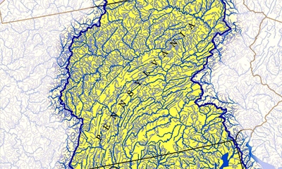
UNDER THE HIGH-TECH EYE: High-tech imagery resolution 900 times that of previous technology can analyze land use down to about 3 feet by 3 feet in Pennsylvania.
“It is important that we identify good practices and become aware of gaps in having these mandated plans,” said Acting DEP Secretary Patrick McDonnell. “These visits will help us document compliance with state requirements and direct resources where they are needed most.”
The visits are to ensure compliance with written plans to:
* properly handle, store and land-apply animal manure and agricultural process wastewater — a manure management plan
* properly manage risks of erosion and runoff from tillage operations and animal heavy-use areas — an ag erosion and sediment control plan
Initial visits will be in high-priority areas of the watershed. McDonnell said that farmers would be contacted in advance to schedule an appointment to discuss the status of those farm plans. “If we’re unable to contact you in advance, we may stop in — adhering to all appropriate biosecurity practices.” He also noted that information collected by DEP or its partners may be subject to inspection or acquisition by others under Pennsylvania’s right-to-know law.
For more details on Pennsylvania’s ag cleanup strategies, click here.
High-resolution eye in the sky
Also last week, the National Fish and Wildlife Foundation awarded funding to the Chesapeake Conservancy for a major restoration and conservation initiative in the Susquehanna River Watershed. The three-year initiative will pilot a new approach to conservation with local partners in Pennsylvania�’s Centre and Clinton counties to reduce nutrient and sediment pollution from nonpoint sources to improve water quality and scenic beauty. Once complete, the project may serve as a national model.
The NFWF grant involves using new high-resolution land cover and LiDAR datasets to better determine precisely where projects will create the highest-impact opportunities for conservation and restoration. The technology has already been used by Chesapeake Conservancy and partners to produce land cover data of 1-by-1 meter resolution (about 3-by-3 feet) for the entire 64,000-square-mile Chesapeake Bay watershed.
This is one of the largest, high-resolution land cover datasets ever produced. It will be open-source data available to all government agencies, nonprofits and individuals across the watershed. With willing landowners, the NFWF project will use the data set to enhance implementation of best management practices — first in the highest-priority locations for Clinton and Centre counties.
“This information, with 900 times the resolution of previously available data, will fundamentally change how conservation and restoration planning are completed,” noted Jeffery Allenby, Chesapeake Conservancy’s director of conservation technology. “Pairing this technology with on-the-ground restoration activities will help people identify the right places, the right scale and the right practices to produce real measurable results.”
You May Also Like
Enter a zip code to see the weather conditions for a different location.


