Subscribe to receive top agriculture news
Be informed daily with these free e-newsletters

The expected La Nina could become a La No-no!
October 14, 2016
It was early summer, and National Oceanic and Atmospheric Administration forecasters in the Climate Prediction Center were gaining confidence that a moderate to strong La Niña could develop by the start of autumn. The history was there, after all. After a strong winter El Niño should come a brief ENSO-neutral period during summer, followed by a moderate to strong La Niña by fall. With La Niña often comes an increased chance of summer drought in the Midwest.

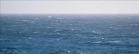
WHERE DID LA NINA GO? Perhaps it’s somewhere out there in the ocean. It’s not here now, and Ken Scheeringa says if a La Niña does develop anytime soon, it will likely be a mild event.
Just to refresh your memory, the El Niño-La Niña cycle refers to warming and cooling of tropical Pacific Ocean surface waters. The temperature moves from warmer than normal to cooler than normal over time. Changes in temperature affect barometric pressure. Exactly where the pools of warmer or cooler water develop and how much area they cover can help determine the intensity of any particular El Niño or La Niña event.
The changes in air pressure affect circulation patterns aloft. While this cycle is only one of several functions that can affect global weather patterns, it is a very strong one. It’s been linked to periods of drought and excess moisture around the globe ranging back over decades.
The cycle first became understood in the 1970s. Jim Newman, a former Purdue University agronomist, spent a good part of his career working on the El Niño-La Niña cycle. He was one of the first to bring out the importance of the cycle in the popular farm press. One of the first times it attracted attention was when it was tied to the 1983 drought across part of the Corn Belt.
Current situation
But the La Niña that was expected for this autumn is a bust. The prospects of a widespread late-summer drought vanished long ago. Some areas developed drought but not on the scale it could have been. In Indiana, moderate drought was limited to a few northeastern counties. Many parts of the state experienced excessive rain events. In southwest Indiana, these rains and the humid, warm weather that followed have been tied to dramatic disease outbreaks in corn in very late summer.
What happened to La Niña? There were certainly signs of cooling in the Pacific Ocean, but the atmosphere did not connect, or “couple up,” with what the ocean was doing. The atmosphere “did not get the memo,” so to speak, and the La Niña process broke down.
The cooling of the ocean sea surface itself has weakened. The Climate Prediction Center forecast has changed, and ENSO-neutral conditions are now favored to continue through the coming winter. El Niño-Southern Oscillation-neutral means sea surface waters are neither warmer nor cooler than normal.
There is a small chance La Niña could still develop in the next few months, but thoughts are that if it does develop, it will be a weak event. Stay tuned!
Scheeringa is Indiana's associate state climatologist. Tom J. Bechman contributed to this story.
You May Also Like
Enter a zip code to see the weather conditions for a different location.


