

Subscribe to receive top agriculture news
Be informed daily with these free e-newsletters

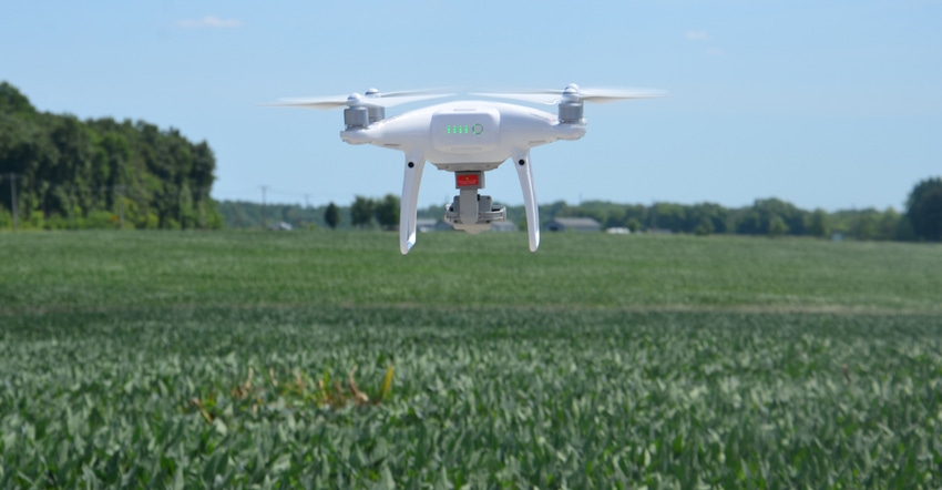
Soybean Watch: Knowing your surroundings is key when scouting fields with a drone.
A small plane flew at a fairly low altitude while Steve Gauck explained to the host farmers of Soybean Watch ’18 how he was going to fly their field. One of the farmers thought the plane was lower than 400 feet. That’s a magic number because unmanned aerial vehicles are allowed to fly to a maximum of 400 feet.
“I’m not sure the small plane was as close to the ground as the farmer thought, but it made the point,” says Gauck, a Beck’s sales agronomist based near Greensburg, Ind. Beck’s sponsors Soybean Watch ’18. “You really have to be aware of your surroundings and do everything correctly when you’re going to scout with a UAV. You certainly don’t want to risk any kind of incident.”

You need a Federal Aviation Administration Part 107 license to fly a drone for scouting purposes. It’s the law. You’re not legal if you’re doing so without the license, even if you’re just scouting your own fields, Gauck says. “You need to prepare, take the test and get your license.”
One of the first things Gauck did before firing up his DJI Phantom IV UAV to scout the Soybean Watch ’18 field was pull up skyvector.com. It’s a website that shows the location of airports and restricted airspace around the country. The Soybean Watch ’18 field is located near various restricted spaces but isn’t within a restricted space itself.

Even if you’re near an airport or other airfield, even a military installation such as Camp Atterbury, it doesn’t mean you won’t be able to fly, Gauck says. “It means you may have to check with the local people before you fly. They need to know about you, and you need to know if it’s OK for you to be in the air with a UAV.”
Understand risks
If you look at the SkyVector website or note the screen in the photo above displaying the website, which Gauck viewed before flying, it may look complicated. He says that’s where the training comes in. Whether you take a live class, buy a book and study it, or do online training, you need to learn some of the same information pilots learn before taking the exam to get a license, Gauck says.
“You need to understand the basic lingo that pilots use, and be able to read maps,” he says. “You want to be responsible and only fly according to the guidelines which the FAA has outlined for drone use.”
Getting the drone with its camera in the air can help you determine where you need to scout first, rather than walking the entire field. It may also indicate patterns of damage from weather or a mechanical application that you can’t see from the ground.
Stay tuned for more on what Gauck learned from flying the Soybean Watch ’18 field.
You May Also Like
Current Conditions for
48°F
Mostly Cloudy
Day 51º
Night 36º
Enter a zip code to see the weather conditions for a different location.


