April 29, 2022

Drone technology may soon offer a powerful tool in helping make replant decisions. First, however, the software must catch up.
“If a farmer can go up and get a bird’s-eye view, they can catch problems so quickly and cover fields efficiently,” says Shaun Casteel, Purdue Extension soybean specialist. Casteel has explored new possibilities with drones in assessing soybean stands.
Related: What you should know about voles
Drones are already used for corn stands, which are less dense and easier to assess than soybean stands.
Interpreting images
It can be nearly impossible to capture soybean numbers with drone footage at the V1 or V2 stage.
“The altitude needed for that resolution is just not practical,” Casteel says. His team is exploring an alternative: observing canopy cover of soybean fields.
“What we’re looking at is correlating the green pixel area — the leaf area — with relative yields at early stages,” Casteel explains. By stitching together drone images from soybean fields, an index can be developed to compare canopy cover and growth stage.
Although Casteel has worked to develop an index, this technology will not become widespread until individual drone companies adopt it. A threshold needs to be created for making replant decisions. That threshold is what his team is trying to determine.
“Companies have the potential to follow this path of assessing soybean stands based on canopy coverage, and they could implement it relatively quickly,” Casteel says. “The catch is defining the critical threshold of canopy to warrant replanting.”
After drone companies incorporate canopy closure or a similar vegetative index into programs, you could use the software on your fields.
Currently, you can work with consultants to capture images to be analyzed off-site. However, without an index and a threshold for considering replanting, those decisions can be difficult based on images from a drone. Once an index becomes adopted by drone companies, you could buy and use your drone to assess soybean stands.
In the meantime
For now, growers must continue assessing soybean stands by walking fields, counting plants and using drones to scan for patterns. Drone footage can still be analyzed for other problems. But walking fields still delivers the most accurate stand count. Drone pictures could help pinpoint thin spots.
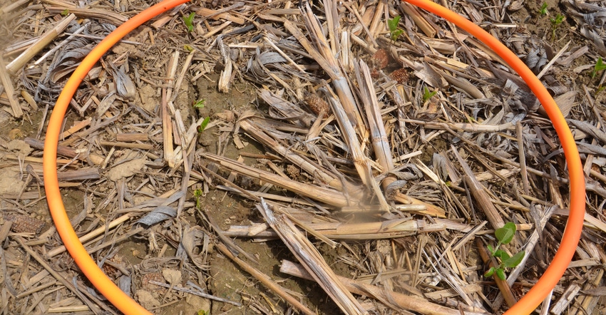
To determine stands, use a hula-hoop with a known diameter. Roll it in at least five random locations. Count plants inside the hoop. The table on Page 112 of the Purdue Corn & Soybean Field Guide, 2022 edition, makes estimating population easy.
Steve Gauck, regional agronomy manager for Beck’s, sponsor of Soybean Watch ’22, offers examples. If you find an average of 12 plants per roll with a 30-inch hoop, that’s 107,000 plants per acre. At seven plants, it’s 62,300 plants per acre.
“You’re in good shape with 107,000, but you may want to consider replanting at 62,000,” Gauck says. “I am usually OK with 80,000 plants if weeds are controlled.”
While technology companies catch up on drone scouting, consider drone prices. “It’s probably anywhere from $1,000 to $3,000 to get into it … including the subscription,” Casteel says. “It just kind of depends on what level you want.”
You need a license to operate a drone on your farm. Purdue offers courses to assist in learning about the technology.
Lund is a student in ag communication at Purdue University. Tom J. Bechman contributed to this story.
You May Also Like


