


Subscribe to receive top agriculture news
Be informed daily with these free e-newsletters
May 9, 2011
Beginning this growing season, SST Software's FarmRite customers will be able to preview and order in-season satellite imagery directly from RapidEye, a major worldwide provider of satellite imagery.
The satellite imagery can be used help identify nutrient needs, recognize potential risks and devise solutions supporting this season’s crops, according to SST. Users will be able to preview a variety of field imagery, purchase only those considered valuable and download them as useable, agX-compliant data layers.
RapidEye, which owns and operates a constellation of five identical Earth observation satellites, has begun tasking its satellites to acquire imagery across the more than 50 million acres of cropland being managed with SST Software products.
“We are excited to have completed the integration of the RapidEye offering and have been thrilled with the feedback we are hearing from growers benefiting from RapidEye imagery products,” says Matt Waits, SST Software vice president. “With agriculture’s increasing demand for information products to help make informed decisions from collected data, we are excited to be helping service providers focus on the needs and expectations of their growers.”
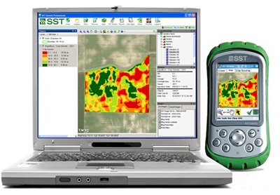
The RapidEye imagery will be available to SST Software customers who use its FarmRite data management and processing service in conjunction with the SST Summit Professional software package. For more information, visit SST Software Premium Services or call 888/377-5334.
You May Also Like
Enter a zip code to see the weather conditions for a different location.


